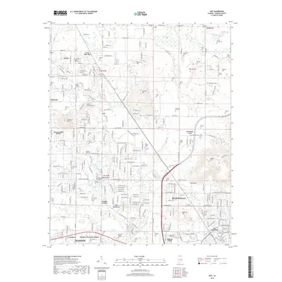
2018 Map of Jeff
USGS Topo · Published 2018About this map
Oakwood University and the expansion of Huntsville anchor this survey of northwestern Madison County. The landscape is a transition between the northern residential reaches of Madison and the rural heritage of Old Monrovia and Jeff. Significant elevation changes are marked by isolated peaks like Capshaw Mountain and Burwell Mountain, which stand in contrast to the developed corridors along Wall Triana Highway.
Find a feature on this map
272 named features on this map. Tap any name to fly to it.
Don’t see what you’re looking for? This feature index may not catch every label — zoom into the map to look around manually.
Map Details
Editions of this 2018 Jeff Map
This is the sole edition of this map. No revisions or reprints were ever made.
Other maps of this area

1888 · Huntsville
USGS Topo · 1:125,000

1892 · Huntsville
USGS Topo · 1:125,000

1936 · Jeff
USGS Topo · 1:24,000

1936 · Capshaw
USGS Topo · 1:24,000

1936 · Madison
USGS Topo · 1:24,000

1936 · Meridianville
USGS Topo · 1:24,000

1936 · Fisk
USGS Topo · 1:24,000

1936 · Ardmore
USGS Topo · 1:24,000

1936 · Toney
USGS Topo · 1:24,000

1936 · Greenbrier
USGS Topo · 1:24,000