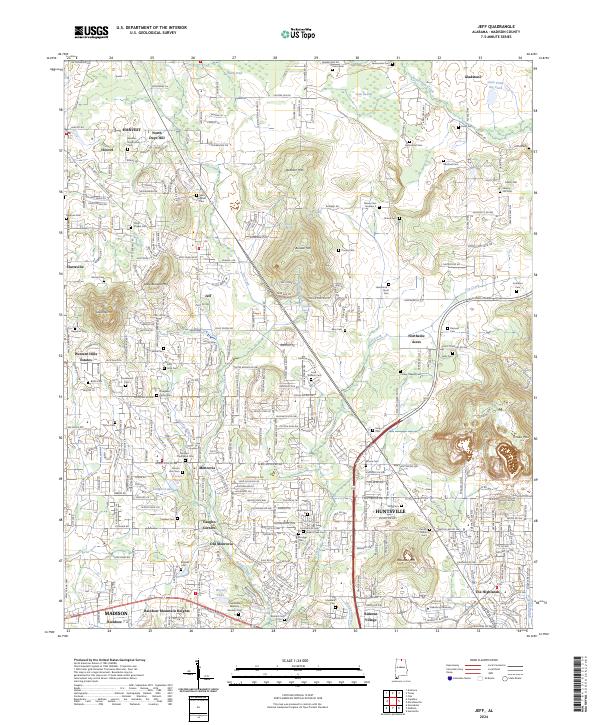
2024 Map of Jeff
USGS Topo · Published 2024About this map
Oakwood University anchors the southern landscape of this northern Alabama region, situated where the growing suburbs of Madison and Huntsville converge. The terrain is defined by prominent peaks like Capshaw Mtn and Burwell Mtn, which rise above the surrounding residential developments of Western Hills Estates and Rainbow Mountain Heights. This modern record reveals a dense network of family history preserved in numerous burial grounds, such as Bouldin-Hammond Cem, Saint James Cem, and Nance Cem, many of which remain tucked between expanding neighborhoods. Waterways like Beaverdam Creek and Indian Creek drain the lowlands, while old crossroads like Cluttsville, Jeff, and Monrovia illustrate the historical settlement patterns of Madison County before its recent suburban transformation.
Find a feature on this map
163 named features on this map. Tap any name to fly to it.
Don’t see what you’re looking for? This feature index may not catch every label — zoom into the map to look around manually.
Map Details
Editions of this 2024 Jeff Map
This is the sole edition of this map. No revisions or reprints were ever made.
Other maps of this area

1888 · Huntsville
USGS Topo · 1:125,000

1892 · Huntsville
USGS Topo · 1:125,000

1936 · Jeff
USGS Topo · 1:24,000

1936 · Capshaw
USGS Topo · 1:24,000

1936 · Madison
USGS Topo · 1:24,000

1936 · Meridianville
USGS Topo · 1:24,000

1936 · Fisk
USGS Topo · 1:24,000

1936 · Ardmore
USGS Topo · 1:24,000

1936 · Toney
USGS Topo · 1:24,000

1936 · Greenbrier
USGS Topo · 1:24,000