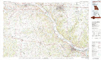
1982 Map of Jefferson City
USGS Topo · Published 1983About this map
Missouri River navigation and the expanding infrastructure of the early 1980s define this regional study of central Missouri. The state capital at Jefferson City and the educational hub of Columbia anchor a landscape of agricultural plains and river bottoms, connected by the Missouri Pacific Railroad and a network of regional airports like Columbia Regional Airport and Boonville Airport. Extensive public lands and conservation areas, including the Mark Twain National Forest and Rock Bridge Memorial State Park, highlight the preservation of the area's natural landmarks, such as the Devils Backbone. The map also documents institutional footprints through the University of Missouri and the Central Missouri Correction Center, alongside numerous rural settlements like Prairie Home, Hartsburg, and Wooldridge that maintain the region's historic character.
Find a feature on this map
149 named features on this map. Tap any name to fly to it.
Don’t see what you’re looking for? This feature index may not catch every label — zoom into the map to look around manually.
Map Details
Editions of this 1982 Jefferson City Map
This is the sole edition of this map. No revisions or reprints were ever made.
Other maps of this area

1886 · Jefferson City
USGS Topo · 1:125,000

1887 · Sedalia
USGS Topo · 1:125,000

1887 · Warsaw
USGS Topo · 1:125,000

1888 · Versailles
USGS Topo · 1:125,000

1888 · Tuscumbia
USGS Topo · 1:125,000

1888 · Boonville
USGS Topo · 1:125,000

1890 · Mexico
USGS Topo · 1:125,000

1890 · Moberly
USGS Topo · 1:125,000

1890 · Glasgow
USGS Topo · 1:125,000

1890 · Fulton
USGS Topo · 1:125,000