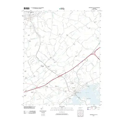
2010 Map of Jefferson City
USGS Topo · Published 2010About this map
Jefferson City and Dandridge anchor this landscape along the northern shores of Douglas Lake. The area reflects a complex history of resource extraction and community growth, evidenced by the industrial presence of the Coy Mine and Athletic Mine near the northern edge, contrasted with the preservation of the Dandridge Historic District to the south. The terrain is defined by a series of ridges and hollows, including Shields Ridge and Hinchey Hollow, which channel numerous tributaries like Dumplin Creek and Goose Creek toward the reservoir.
Find a feature on this map
126 named features on this map. Tap any name to fly to it.
Don’t see what you’re looking for? This feature index may not catch every label — zoom into the map to look around manually.
Map Details
Editions of this 2010 Jefferson City Map
This is the sole edition of this map. No revisions or reprints were ever made.
Other maps of this area

1883 · Morristown
USGS Topo · 1:125,000

1886 · Knoxville
USGS Topo · 1:125,000

1892 · Knoxville
USGS Topo · 1:125,000

1893 · Mt Guyot
USGS Topo · 1:125,000

1893 · Morristown
USGS Topo · 1:125,000

1894 · Knoxville
USGS Topo · 1:125,000

1895 · Morristown
USGS Topo · 1:125,000

1895 · Knoxville
USGS Topo · 1:125,000

1897 · Maynardville
USGS Topo · 1:125,000

1900 · Maynardville
USGS Topo · 1:125,000