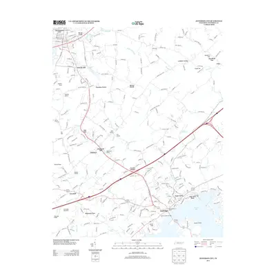
2013 Map of Jefferson City
USGS Topo · Published 2013About this map
Jefferson City and Dandridge serve as the primary anchors of this East Tennessee landscape, where the waters of Douglas Lake meet the foothills of the Appalachian range. The map illustrates a complex network of ridges and hollows, including Newman Ridge and Hinchey Hollow, interspersed with legacy agricultural landmarks like Hunnicutt Mill. To the south, the James D Hoskins Bridge provides a vital link over the reservoir, while the interior is dotted with small communities like Grants Chapel and Gravelly Hill.
Find a feature on this map
257 named features on this map. Tap any name to fly to it.
Don’t see what you’re looking for? This feature index may not catch every label — zoom into the map to look around manually.
Map Details
Editions of this 2013 Jefferson City Map
This is the sole edition of this map. No revisions or reprints were ever made.
Other maps of this area

1883 · Morristown
USGS Topo · 1:125,000

1886 · Knoxville
USGS Topo · 1:125,000

1892 · Knoxville
USGS Topo · 1:125,000

1893 · Mt Guyot
USGS Topo · 1:125,000

1893 · Morristown
USGS Topo · 1:125,000

1894 · Knoxville
USGS Topo · 1:125,000

1895 · Morristown
USGS Topo · 1:125,000

1895 · Knoxville
USGS Topo · 1:125,000

1897 · Maynardville
USGS Topo · 1:125,000

1900 · Maynardville
USGS Topo · 1:125,000