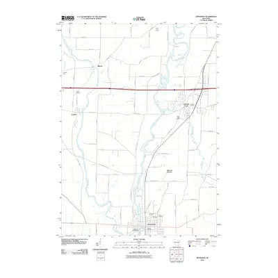
2010 Map of Jefferson
USGS Topo · Published 2010About this map
The Rock River and Crawfish River converge in this Jefferson County landscape, shaping the development of Jefferson and surrounding hamlets. The map documents the spatial relationship between established communities like Johnson Creek and Jefferson Junction, where transport corridors intersect. Local history and genealogy are anchored by numerous burial grounds, including Greenwood Cemetery, Saint John Cemetery, and Evergreen Cemetery.
Find a feature on this map
65 named features on this map. Tap any name to fly to it.
Don’t see what you’re looking for? This feature index may not catch every label — zoom into the map to look around manually.
Map Details
Editions of this 2010 Jefferson Map
This is the sole edition of this map. No revisions or reprints were ever made.
Other maps of this area

1891 · Waterloo
USGS Topo · 1:62,500

1891 · Koshkonong
USGS Topo · 1:62,500

1892 · Watertown
USGS Topo · 1:62,500

1892 · Whitewater
USGS Topo · 1:62,500

1893 · Whitewater
USGS Topo · 1:62,500

1894 · Waterloo
USGS Topo · 1:62,500

1894 · Watertown
USGS Topo · 1:62,500

1894 · Koshkonong
USGS Topo · 1:62,500

1903 · Whitewater
USGS Topo · 1:62,500

1906 · Koshkonong
USGS Topo · 1:62,500