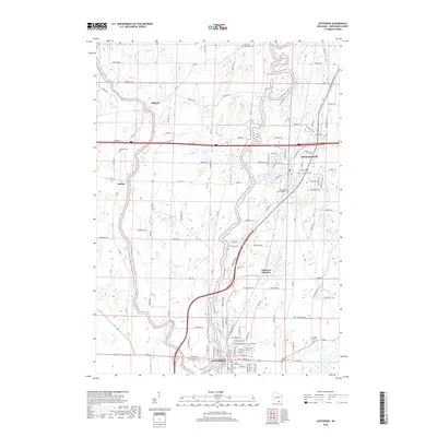
2018 Map of Jefferson
USGS Topo · Published 2018About this map
The Rock River and Crawfish River converge at the southern end of this landscape, framing the city of Jefferson and its surrounding agricultural townships. The area is marked by a high density of burial grounds, providing significant resources for genealogical research, including German Methodist Cem, Evergreen Cem, and Christberg Cem. Moving north, the settlement of Milford sits along the Crawfish River, while the village of Aztalan is situated to the west. A complex network of county roads like Co Rd B and Co Rd A connects these rural communities, while the Interstate 94 corridor cuts through the northern half of the region near Johnson Creek. At Jefferson Junction, the rail-dependent history of the area is visible where transportation lines meet amidst a landscape of low-lying wetlands and well-drained farmlands typical of this part of the state.
Find a feature on this map
122 named features on this map. Tap any name to fly to it.
Don’t see what you’re looking for? This feature index may not catch every label — zoom into the map to look around manually.
Map Details
Editions of this 2018 Jefferson Map
This is the sole edition of this map. No revisions or reprints were ever made.
Other maps of this area

1891 · Waterloo
USGS Topo · 1:62,500

1891 · Koshkonong
USGS Topo · 1:62,500

1892 · Watertown
USGS Topo · 1:62,500

1892 · Whitewater
USGS Topo · 1:62,500

1893 · Whitewater
USGS Topo · 1:62,500

1894 · Waterloo
USGS Topo · 1:62,500

1894 · Watertown
USGS Topo · 1:62,500

1894 · Koshkonong
USGS Topo · 1:62,500

1903 · Whitewater
USGS Topo · 1:62,500

1906 · Koshkonong
USGS Topo · 1:62,500