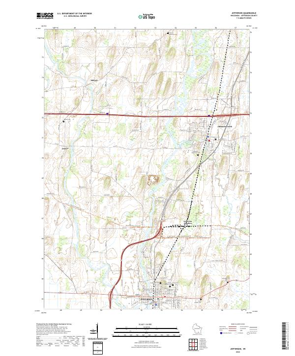
2022 Map of Jefferson
USGS Topo · Published 2022About this map
The Jefferson city center and the convergence of the Crawfish River and Rock River anchor this 2022 survey of southern Wisconsin. This landscape is defined by the historic importance of the river systems and the resulting transportation network that links Milford, Aztalan, and Johnson Creek. The presence of the Jefferson County Courthouse marks the seat of local administration, while the density of memorial sites such as Greenwood Cem, Saint John's Catholic Cem, and Union Cem provides significant data for genealogical research.
Find a feature on this map
129 named features on this map. Tap any name to fly to it.
Don’t see what you’re looking for? This feature index may not catch every label — zoom into the map to look around manually.
Map Details
Editions of this 2022 Jefferson Map
This is the sole edition of this map. No revisions or reprints were ever made.
Other maps of this area

1891 · Waterloo
USGS Topo · 1:62,500

1891 · Koshkonong
USGS Topo · 1:62,500

1892 · Watertown
USGS Topo · 1:62,500

1892 · Whitewater
USGS Topo · 1:62,500

1893 · Whitewater
USGS Topo · 1:62,500

1894 · Waterloo
USGS Topo · 1:62,500

1894 · Watertown
USGS Topo · 1:62,500

1894 · Koshkonong
USGS Topo · 1:62,500

1903 · Whitewater
USGS Topo · 1:62,500

1906 · Koshkonong
USGS Topo · 1:62,500