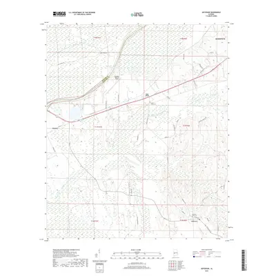
2018 Map of Jefferson
USGS Topo · Published 2018About this map
Coffeeville Lake and the winding course of the Tombigbee River define the western border of this landscape on the Sumter and Marengo county line. The terrain is a network of lowlands and creek drainages, including Mill Creek and Lost Creek, surrounding the southern outskirts of Demopolis. In the southern portion of the quadrangle, the community of Jefferson sits at a crossroads near Smalls Cem, while the industrial legacy of the region is noted by the Gulf States Paper Company Lake. This area serves as a significant transportation and aviation hub for West Alabama, anchored by the Demopolis Regional Airport and the junction of major routes like AL Highway 28. Smaller historic markers such as Millers Chapel Cem and the settlement of Salt Well provide touchstones for local genealogical research.
Find a feature on this map
53 named features on this map. Tap any name to fly to it.
Don’t see what you’re looking for? This feature index may not catch every label — zoom into the map to look around manually.
Map Details
Editions of this 2018 Jefferson Map
This is the sole edition of this map. No revisions or reprints were ever made.
Other maps of this area

1929 · Epes
USGS Topo · 1:48,000

1932 · Epes
USGS Topo · 1:62,500

1946 · Demopolis
USGS Topo · 1:24,000

1947 · Demopolis
USGS Topo · 1:24,000

1948 · Mc Dowell
USGS Topo · 1:24,000

1949 · Mc Dowell
USGS Topo · 1:24,000

1953 · Montgomery
USGS Topo · 1:250,000

1953 · Meridian
USGS Topo · 1:250,000

1956 · Montgomery
USGS Topo · 1:250,000

1957 · Meridian
USGS Topo · 1:250,000