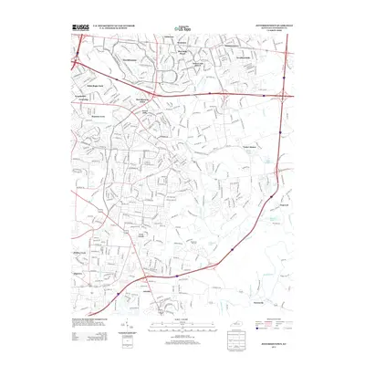
2013 Map of Jeffersontown
USGS Topo · Published 2013About this map
Middletown and Fern Creek anchor this detailed suburban landscape east of Louisville, where established neighborhoods meet the winding drainage basins of the S Fork Beargrass Cr and Floyds Fork. The map documents a dense network of residential developments such as Douglass Hills and Blue Ridge Manor, interspersed with older nodes like Tucker Station and Hopewell. This area preserves pockets of its rural past even as it transforms into a modern residential hub, evidenced by the Chenoweth Run Cem situated near the headwaters of Chenoweth Run. Transportation corridors like the Bluegrass Pkwy and Watterson Trl cut through the terrain, connecting smaller settlements like Ashville and Seatonville to the larger metropolitan area.
Find a feature on this map
44 named features on this map. Tap any name to fly to it.
Don’t see what you’re looking for? This feature index may not catch every label — zoom into the map to look around manually.
Map Details
Editions of this 2013 Jeffersontown Map
This is the sole edition of this map. No revisions or reprints were ever made.
Other maps of this area

1905 · Prospect
USGS Topo · 1:62,500

1907 · Louisville
USGS Topo · 1:62,500

1912 · Prospect
USGS Topo · 1:62,500

1929 · Taylorsville
USGS Topo · 1:62,500

1932 · La Grange
USGS Topo · 1:62,500

1937 · Jeffersonville
USGS Topo · 1:24,000

1946 · Jeffersonville
USGS Topo · 1:24,000

1951 · Anchorage
USGS Topo · 1:24,000

1951 · Crestwood
USGS Topo · 1:24,000
1951 · Jeffersonville
USGS Topo · 1:24,000