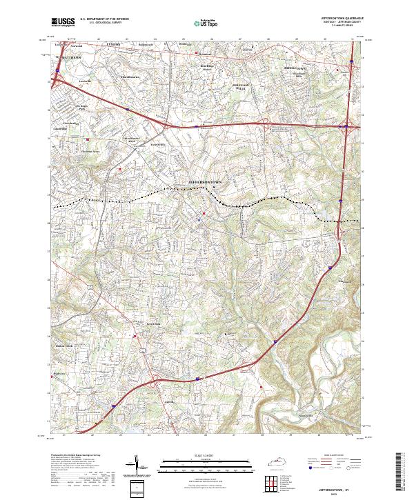
2022 Map of Jeffersontown
USGS Topo · Published 2022About this map
The suburban landscape of eastern Jefferson County is defined by a dense network of residential developments and historical crossroads established along major corridors like Shelbyville Rd and Taylorsville Rd. Centered on the city of Jeffersontown, the area transitioned from its agrarian origins into a sprawling collection of named neighborhoods including Blue Ridge Manor, Douglass Hills, and Hurstbourne Acres. Despite the intense development of the early 21st century, remnants of the area's older history persist in sites like the Middletown Historic Cem and Chenoweth Run Cem. To the east and south, the terrain follows the winding course of Floyds Fork and Chenoweth Run, where the topography remains more varied near settlements like Seatonville and Ashville. The map captures a moment when traditional community centers like Middletown and St. Matthews have become integrated into the greater Louisville metropolitan fabric.
Find a feature on this map
47 named features on this map. Tap any name to fly to it.
Don’t see what you’re looking for? This feature index may not catch every label — zoom into the map to look around manually.
Map Details
Editions of this 2022 Jeffersontown Map
This is the sole edition of this map. No revisions or reprints were ever made.
Other maps of this area

1905 · Prospect
USGS Topo · 1:62,500

1907 · Louisville
USGS Topo · 1:62,500

1912 · Prospect
USGS Topo · 1:62,500

1929 · Taylorsville
USGS Topo · 1:62,500

1932 · La Grange
USGS Topo · 1:62,500

1937 · Jeffersonville
USGS Topo · 1:24,000

1946 · Jeffersonville
USGS Topo · 1:24,000

1951 · Anchorage
USGS Topo · 1:24,000

1951 · Crestwood
USGS Topo · 1:24,000
1951 · Jeffersonville
USGS Topo · 1:24,000