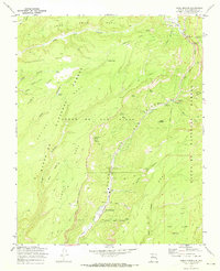
1970 Map of Jemez Springs
USGS Topo · Published 1973About this map
Jemez Springs serves as the focal point of this 1970 landscape, where the Jemez River carves deeply through the canyon floor. The map highlights a community defined by its natural thermal activity and religious landmarks, notably the Via Coeli Monastery and nearby Hot Springs. High mesas like Mesa Cebollita and San Juan Mesa overlook the valley, revealing a terrain utilized for recreation and resource management by the Santa Fe National Forest.
Find a feature on this map
52 named features on this map. Tap any name to fly to it.
Don’t see what you’re looking for? This feature index may not catch every label — zoom into the map to look around manually.
Map Details
Editions of this 1970 Jemez Springs Map
Other maps of this area

1890 · Jemes
USGS Topo · 1:125,000

1892 · Jemes
USGS Topo · 1:125,000

1937 · Jemez Springs
USGS Topo · 1:48,000

1939 · La Ventana
USGS Topo · 1:62,500

1939 · San Ysidro
USGS Topo · 1:62,500

1943 · San Ysidro
USGS Topo · 1:62,500

1943 · Jemez
USGS Topo · 1:62,500

1943 · La Ventana
USGS Topo · 1:62,500

1944 · Jemez Springs
USGS Topo · 1:62,500

1952 · Jemez Springs
USGS Topo · 1:62,500