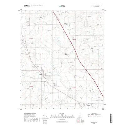
2018 Map of Jemison East
USGS Topo · Published 2018About this map
Thorsby serves as a central hub on this map, showing a concentrated street grid that reflects its history as an agricultural and rail-oriented community. The area is notable for its numerous burial grounds, including the Thorsby Scandinavian Cem and Thorsby Memorial Cem, which speak to the immigrant heritage and early settlement patterns of Chilton County. To the north, the landscape transitions into smaller communities like Rocky Mount and Union Grove, while the eastern portion of the sheet is defined by Chandler Mtn and the waters of Turkey Cr. A network of creeks, including Charlotte Cr and Mulberry Cr, drains the varied topography. For those interested in local heritage, the map identifies small rural centers such as Collins Chapel and Mineral Springs, each anchored by their namesake churches and cemeteries, alongside water features like Fountainhead Lake and Bentleys Lake.
Find a feature on this map
193 named features on this map. Tap any name to fly to it.
Don’t see what you’re looking for? This feature index may not catch every label — zoom into the map to look around manually.
Map Details
Editions of this 2018 Jemison East Map
This is the sole edition of this map. No revisions or reprints were ever made.
Other maps of this area

1890 · Bessemer
USGS Topo · 1:125,000

1891 · Clanton
USGS Topo · 1:125,000

1892 · Bessemer
USGS Topo · 1:125,000

1909 · Columbiana
USGS Topo · 1:62,500

1910 · Montevallo
USGS Topo · 1:62,500

1911 · Columbiana
USGS Topo · 1:62,500

1953 · Montgomery
USGS Topo · 1:250,000

1953 · Birmingham
USGS Topo · 1:250,000

1956 · Birmingham
USGS Topo · 1:250,000

1956 · Montgomery
USGS Topo · 1:250,000