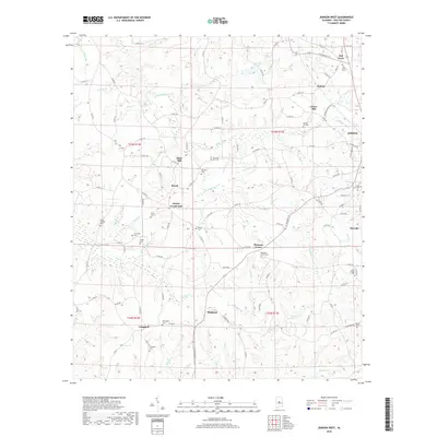
2018 Map of Jemison West
USGS Topo · Published 2018About this map
Mahan Creek and its many tributaries, including Mohorn Cr and Sam Br, carve through this section of Chilton County, defining a landscape of small agricultural settlements and rural communities. The map serves as a vital record for genealogists, documenting numerous family and community burial grounds such as Crumpton Cem, Jones Cem, and Shiloh Cem. The density of these cemeteries around crossroads like Poseys Crossroads and Mars Hill suggests a long-established network of small-scale farming homesteads and parish life. To the south, the terrain slopes toward Mulberry Cr, while the eastern edge is marked by the growth of Jemison and Thorsby. This survey captures the intricate system of county roads, such as Co RD 42 and Co RD 50, that have historically linked these dispersed Alabama townships.
Find a feature on this map
115 named features on this map. Tap any name to fly to it.
Don’t see what you’re looking for? This feature index may not catch every label — zoom into the map to look around manually.
Map Details
Editions of this 2018 Jemison West Map
This is the sole edition of this map. No revisions or reprints were ever made.
Other maps of this area

1890 · Bessemer
USGS Topo · 1:125,000

1891 · Clanton
USGS Topo · 1:125,000

1892 · Bessemer
USGS Topo · 1:125,000

1909 · Columbiana
USGS Topo · 1:62,500

1910 · Montevallo
USGS Topo · 1:62,500

1911 · Columbiana
USGS Topo · 1:62,500

1953 · Montgomery
USGS Topo · 1:250,000

1953 · Birmingham
USGS Topo · 1:250,000

1956 · Birmingham
USGS Topo · 1:250,000

1956 · Montgomery
USGS Topo · 1:250,000