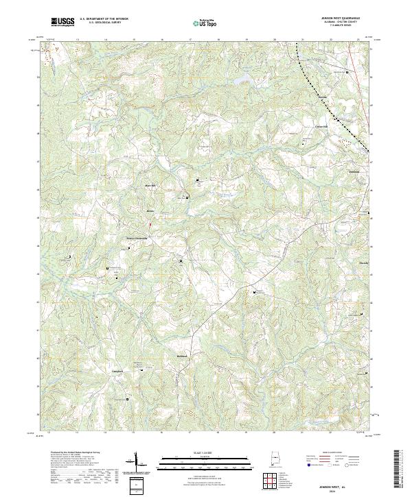
2024 Map of Jemison West
USGS Topo · Published 2024About this map
Macedonia Baptist Church Cem and numerous family burying grounds define the rural landscape of this Chilton County territory. The terrain is intricately carved by a dense network of waterways, including the winding Sixmile Creek and Mahan Creek, which flow through heavily timbered sections and small agricultural clearings. Small community clusters such as Poseys Crossroads and Hubbard serve as local landmarks along the county road system, while the larger municipalities of Jemison and Thorsby appear on the eastern margin. This modern topography reveals a transition where established rural crossroads like Bessie and Mars Hill remain identifiable through their named cemeteries and road junctions, preserving the spatial layout of historic Alabama farm life. Notable water features like Brantley Lake and various branches such as Gold Mine Branch further distinguish the geography of this upland region.
Find a feature on this map
116 named features on this map. Tap any name to fly to it.
Don’t see what you’re looking for? This feature index may not catch every label — zoom into the map to look around manually.
Map Details
Editions of this 2024 Jemison West Map
This is the sole edition of this map. No revisions or reprints were ever made.
Other maps of this area

1890 · Bessemer
USGS Topo · 1:125,000

1891 · Clanton
USGS Topo · 1:125,000

1892 · Bessemer
USGS Topo · 1:125,000

1909 · Columbiana
USGS Topo · 1:62,500

1910 · Montevallo
USGS Topo · 1:62,500

1911 · Columbiana
USGS Topo · 1:62,500

1953 · Montgomery
USGS Topo · 1:250,000

1953 · Birmingham
USGS Topo · 1:250,000

1956 · Birmingham
USGS Topo · 1:250,000

1956 · Montgomery
USGS Topo · 1:250,000