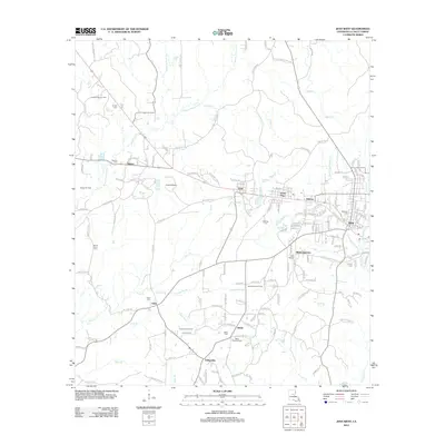
2012 Map of Jena West
USGS Topo · Published 2012About this map
Jena and its neighboring communities are defined by a landscape deeply connected to the timber and petroleum industries of LaSalle Parish. The settlement pattern follows a distinct east-west corridor, where the historic company town of Trout and the nearby Good Pine sit along the drainage of Trout Creek. These communities reflect the industrial growth of the region, anchored by infrastructure like the Jena Airport and the local Post Office.
Find a feature on this map
155 named features on this map. Tap any name to fly to it.
Don’t see what you’re looking for? This feature index may not catch every label — zoom into the map to look around manually.
Map Details
Editions of this 2012 Jena West Map
This is the sole edition of this map. No revisions or reprints were ever made.
Other maps of this area

1936 · Pollock
USGS Topo · 1:62,500

1941 · Jena
USGS Topo · 1:62,500

1941 · Pollock
USGS Topo · 1:62,500

1953 · Alexandria
USGS Topo · 1:250,000

1954 · Tullos
USGS Topo · 1:62,500

1955 · Alexandria
USGS Topo · 1:250,000

1955 · Olla
USGS Topo · 1:62,500

1958 · Pollock
USGS Topo · 1:62,500

1958 · Jena
USGS Topo · 1:62,500
1984 · Summerville
USGS Topo · 1:24,000