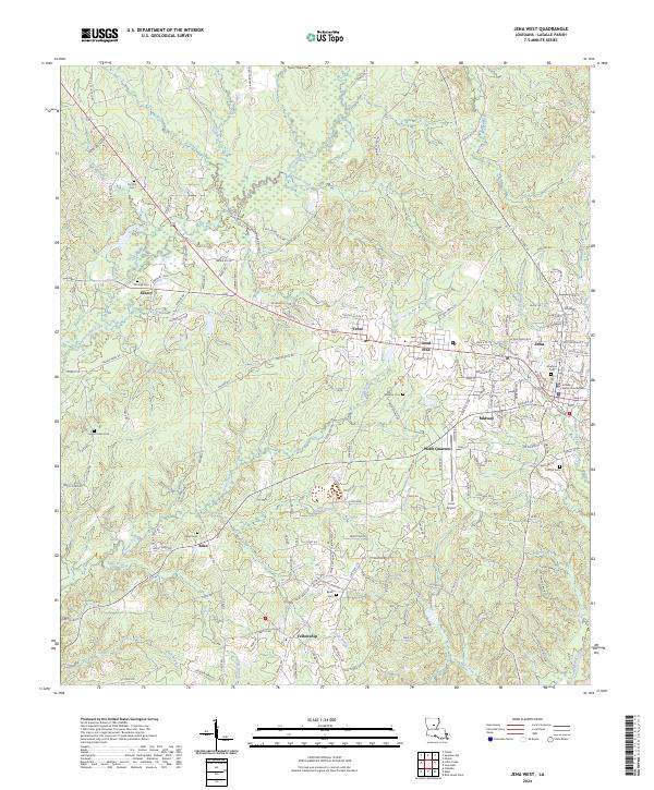
2024 Map of Jena West
USGS Topo · Published 2024About this map
The LaSalle Parish Courthouse stands as the civic anchor in Jena, the primary hub of this central Louisiana landscape. The area is defined by a dense network of timberlands and small settlements like Trout, Good Pine, and Midway, which developed historically around the regional lumber industry. This 2024 survey captures a rural environment where numerous family and community burial grounds, such as Mount Sinai Cem and Taylor Chapel Cem, are preserved among the watersheds of Bayou Funny Louis and Hemphill Creek. The map details a landscape transitioning from the traditional town centers to more dispersed rural residential patterns, including the Webb Quarters and the community of Fellowship. Aviation and education infrastructure are clearly marked at the Jena Airport and Jena High School, reflecting the modern development that continues to shape the Parish's seat of government.
Find a feature on this map
168 named features on this map. Tap any name to fly to it.
Don’t see what you’re looking for? This feature index may not catch every label — zoom into the map to look around manually.
Map Details
Editions of this 2024 Jena West Map
This is the sole edition of this map. No revisions or reprints were ever made.
Other maps of this area

1936 · Pollock
USGS Topo · 1:62,500

1941 · Jena
USGS Topo · 1:62,500

1941 · Pollock
USGS Topo · 1:62,500

1953 · Alexandria
USGS Topo · 1:250,000

1954 · Tullos
USGS Topo · 1:62,500

1955 · Alexandria
USGS Topo · 1:250,000

1955 · Olla
USGS Topo · 1:62,500

1958 · Pollock
USGS Topo · 1:62,500

1958 · Jena
USGS Topo · 1:62,500
1984 · Summerville
USGS Topo · 1:24,000