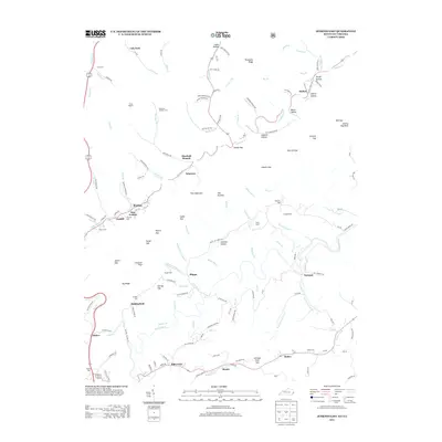
2013 Map of Jenkins East
USGS Topo · Published 2013About this map
Pine Mountain and the high ridges of the Cumberland Plateau dominate this landscape along the Kentucky-Virginia border, where the headwaters of the Pound River and Elkhorn Cr carve deep valleys. The terrain is defined by a dense network of hollows and gaps, including Vanover Hollow, Baker Hollow, and Shelby Gap, which dictated the early settlement patterns and road placements in this coal-rich region. Industrial activity is evident near East Jenkins and Burdine, where mining operations such as No 1 HL and No 2 HL are marked alongside established communities like Mill Creek and Hylton. Genealogy researchers will find numerous family burial grounds throughout the area, such as the Pebelton Johnson Cem, Haddon Cem, and Elkins Cem, often situated on the lower slopes near creek branches. These locations, combined with landmarks like Johnny Bug Rock and The Doubles, provide a detailed view of the localized geography and community structure in Letcher County during the early 21st century.
Find a feature on this map
121 named features on this map. Tap any name to fly to it.
Don’t see what you’re looking for? This feature index may not catch every label — zoom into the map to look around manually.
Map Details
Editions of this 2013 Jenkins East Map
This is the sole edition of this map. No revisions or reprints were ever made.
Other maps of this area

1886 · Grundy
USGS Topo · 1:125,000

1890 · Whitesburg
USGS Topo · 1:125,000

1890 · Grundy
USGS Topo · 1:125,000

1892 · Grundy
USGS Topo · 1:125,000

1892 · Whitesburg
USGS Topo · 1:125,000

1912 · Pound
USGS Topo · 1:48,000

1913 · Clintwood
USGS Topo · 1:62,500

1914 · Pound
USGS Topo · 1:62,500

1914 · Vergie
USGS Topo · 1:48,000

1915 · Clintwood
USGS Topo · 1:62,500