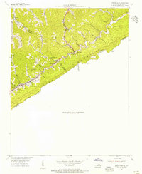
1954 Map of Jenkins East
USGS Topo · Published 1955About this map
Pine Mountain serves as a massive natural barrier along the Kentucky and Virginia border, defining the sharp topography of the Central Appalachian coalfields in the mid-1950s. The coal industry's footprint is evident in the dense network of industrial sites and company towns, from the main hub at Jenkins to satellite settlements like Burdine and Gaskill. The infrastructure of the Chesapeake and Ohio railroad follows the winding path of Elkhorn Creek, connecting these mountain communities.
Find a feature on this map
48 named features on this map. Tap any name to fly to it.
Don’t see what you’re looking for? This feature index may not catch every label — zoom into the map to look around manually.
Map Details
Editions of this 1954 Jenkins East Map
This is the sole edition of this map. No revisions or reprints were ever made.
Other maps of this area

1886 · Grundy
USGS Topo · 1:125,000

1890 · Whitesburg
USGS Topo · 1:125,000

1890 · Grundy
USGS Topo · 1:125,000

1892 · Grundy
USGS Topo · 1:125,000

1892 · Whitesburg
USGS Topo · 1:125,000

1912 · Pound
USGS Topo · 1:48,000

1913 · Clintwood
USGS Topo · 1:62,500

1914 · Pound
USGS Topo · 1:62,500

1914 · Vergie
USGS Topo · 1:48,000

1915 · Clintwood
USGS Topo · 1:62,500