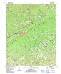
1992 Map of Jenkins East
USGS Topo · Published 1992About this map
Pine Mountain forms the backbone of this landscape along the Kentucky Virginia border, where the headwaters of the Pound River and Elkhorn Creek have carved a network of steep hollows. The area’s economic history is etched into the terrain through numerous gas wells, an extensive quarry near Burdine, and several strip mines that mark the ridgelines. These industrial features coexist with a deeply rooted community structure, evidenced by small mountain settlements like Shelby Gap, Haddonfield, and Beefhide.
Find a feature on this map
96 named features on this map. Tap any name to fly to it.
Don’t see what you’re looking for? This feature index may not catch every label — zoom into the map to look around manually.
Map Details
Editions of this 1992 Jenkins East Map
This is the sole edition of this map. No revisions or reprints were ever made.
Other maps of this area

1886 · Grundy
USGS Topo · 1:125,000

1890 · Whitesburg
USGS Topo · 1:125,000

1890 · Grundy
USGS Topo · 1:125,000

1892 · Grundy
USGS Topo · 1:125,000

1892 · Whitesburg
USGS Topo · 1:125,000

1912 · Pound
USGS Topo · 1:48,000

1913 · Clintwood
USGS Topo · 1:62,500

1914 · Pound
USGS Topo · 1:62,500

1914 · Vergie
USGS Topo · 1:48,000

1915 · Clintwood
USGS Topo · 1:62,500