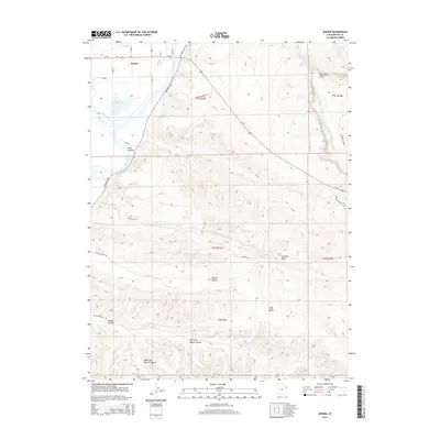
2014 Map of Jensen
USGS Topo · Published 2014About this map
The Green River carves a path through this section of eastern Utah, where the settlement of Jensen sits at the junction of Us-40 and the river's edge. This 2014 survey documents a landscape defined by dramatic geological features and the management of water resources in an arid environment. Near the town, Stewart Lake and the mouth of Ashley Cr provide critical riparian habitat, contrasting with the high-desert plateaus to the south and east.
Find a feature on this map
31 named features on this map. Tap any name to fly to it.
Don’t see what you’re looking for? This feature index may not catch every label — zoom into the map to look around manually.
Map Details
Editions of this 2014 Jensen Map
This is the sole edition of this map. No revisions or reprints were ever made.
Other maps of this area

1885 · Ashley
USGS Topo · 1:250,000

1907 · Jensen
USGS Topo · 1:125,000

1910 · Jensen
USGS Topo · 1:125,000

1954 · Vernal
USGS Topo · 1:250,000

1955 · Split Mountain
USGS Topo · 1:24,000

1958 · Vernal
USGS Topo · 1:250,000

1960 · Vernal
USGS Topo · 1:250,000
1965 · Dinosaur Quarry
USGS Topo · 1:24,000
1965 · Rasmussen Hollow
USGS Topo · 1:24,000
1965 · Naples
USGS Topo · 1:24,000