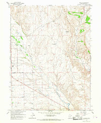
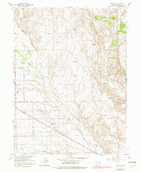
1965 Map of Naples
USGS Topo · Published 1967About this map
Naples serves as a primary settlement within the expansive Ashley Valley, an area defined by its complex irrigation and industrial infrastructure in the mid-1960s. The landscape is marked by a network of utilities, including a significant Pipeline, a Vernal Substation, and a Radio Facility, reflecting the region's mid-century development. Water management is central to life here, evidenced by the presence of Ashley Creek, Brush Creek, and the Burns Bench Reservoir, which support both the local community and agricultural interests in the surrounding benchlands.
Find a feature on this map
22 named features on this map. Tap any name to fly to it.
Don’t see what you’re looking for? This feature index may not catch every label — zoom into the map to look around manually.
Map Details
Editions of this 1965 Naples Map
2 editions found
Other maps of this area

1885 · Ashley
USGS Topo · 1:250,000

1906 · Marsh Peak
USGS Topo · 1:125,000

1907 · Jensen
USGS Topo · 1:125,000

1908 · Marsh Peak
USGS Topo · 1:125,000

1910 · Jensen
USGS Topo · 1:125,000
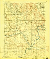
1917 · Vernal
USGS Topo · 1:125,000

1954 · Vernal
USGS Topo · 1:250,000

1958 · Vernal
USGS Topo · 1:250,000

1960 · Vernal
USGS Topo · 1:250,000
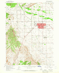
1964 · Vernal NE
USGS Topo · 1:24,000