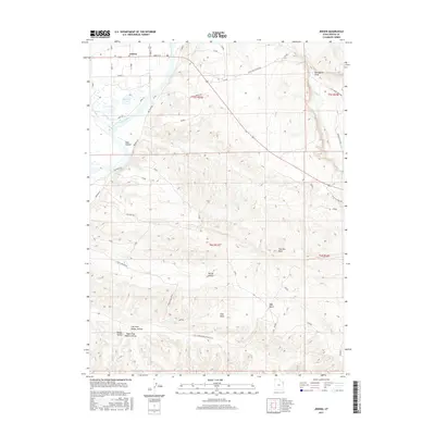
2017 Map of Jensen
USGS Topo · Published 2017About this map
Jensen serves as the primary settlement hub in this northeastern Utah landscape, situated near the confluence of Ashley Cr and the winding Green River. The topography is defined by a series of significant basins and draws, including Clay Basin and the extensive Walker Hollow system, which branches into Left Fork Walker Hollow and Right Fork Walker Hollow. The presence of Stewart Lake near the river indicates the riparian character of the lowlands, contrasting with the elevated plateaus of Sage Bench and the prominent geological feature of The Rim Rock. A network of utility and access roads, such as Red Wash Rd and Pole Line Wash Rd, crisscrosses the township, reflecting the area's development for resource management and local transit between the rugged canyons and the river valley.
Find a feature on this map
27 named features on this map. Tap any name to fly to it.
Don’t see what you’re looking for? This feature index may not catch every label — zoom into the map to look around manually.
Map Details
Editions of this 2017 Jensen Map
This is the sole edition of this map. No revisions or reprints were ever made.
Other maps of this area

1885 · Ashley
USGS Topo · 1:250,000

1907 · Jensen
USGS Topo · 1:125,000

1910 · Jensen
USGS Topo · 1:125,000

1954 · Vernal
USGS Topo · 1:250,000

1955 · Split Mountain
USGS Topo · 1:24,000

1958 · Vernal
USGS Topo · 1:250,000

1960 · Vernal
USGS Topo · 1:250,000
1965 · Dinosaur Quarry
USGS Topo · 1:24,000
1965 · Rasmussen Hollow
USGS Topo · 1:24,000
1965 · Naples
USGS Topo · 1:24,000