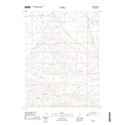
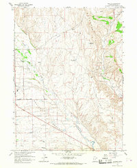
2020 Map of Jensen
USGS Topo · Published 2020About this map
Jensen occupies the northwestern corner of this landscape, situated near the confluence of Ashley Cr and the Green River. The river corridor dominates the western edge of the quadrangle, where the expansive Stewart Lake provides a distinct hydrological feature amidst the surrounding arid terrain. Moving east and south from the river, the topography transitions into a complex system of drainage basins and ridges, including Kane Hollow, Clay Basin, and the extensive Walker Hollow network. A significant geologic formation known as The Rim Rock defines the central and eastern portions of the map, reached by Rim Rock Rd. The road network, including Red Wash Rd and Pole Line Wash Rd, suggests a landscape utilized for local transit and utility access, while the Cliff Creek Overlook provides a vantage point over the winding path of Cliff Cr as it cuts through the northeastern hills.
Find a feature on this map
68 named features on this map. Tap any name to fly to it.
Don’t see what you’re looking for? This feature index may not catch every label — zoom into the map to look around manually.
Map Details
Editions of this 2020 Jensen Map
This is the sole edition of this map. No revisions or reprints were ever made.
Other maps of this area

1885 · Ashley
USGS Topo · 1:250,000
1907 · Jensen
USGS Topo · 1:125,000
1910 · Jensen
USGS Topo · 1:125,000

1954 · Vernal
USGS Topo · 1:250,000
1955 · Split Mountain
USGS Topo · 1:24,000
1958 · Vernal
USGS Topo · 1:250,000
1960 · Vernal
USGS Topo · 1:250,000
1965 · Dinosaur Quarry
USGS Topo · 1:24,000
1965 · Rasmussen Hollow
USGS Topo · 1:24,000
1965 · Naples
USGS Topo · 1:24,000