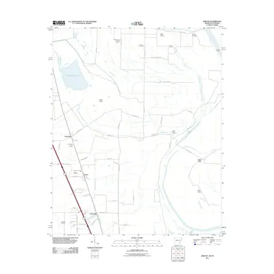
2011 Map of Jericho
USGS Topo · Published 2011About this map
Wapanocca Lake and the wetlands of the Mississippi River floodplain define the landscape of eastern Arkansas in this 2011 survey. The region is characterized by small, dispersed settlements like Clarkedale and Jericho, connected by a network of rural roads that navigate the low-lying terrain near Fifteenmile Bayou. Agricultural land use is evident in the presence of named rises such as Pecan Ridge and large islands within the river system like Island Forty and Beef Island. For those researching local heritage, the map identifies several rural burial grounds, including New Mount Zion Cemetery, Sunrise Cemetery, and Saint Marks Cemetery. The presence of the Turrell Flying Service Airport and the crossroads at James Mill underscore the intersection of aviation and traditional farming infrastructure in Crittenden County.
Find a feature on this map
54 named features on this map. Tap any name to fly to it.
Don’t see what you’re looking for? This feature index may not catch every label — zoom into the map to look around manually.
Map Details
Editions of this 2011 Jericho Map
This is the sole edition of this map. No revisions or reprints were ever made.
Other maps of this area

1916 · Memphis
USGS Topo · 1:62,500

1925 · Memphis
USGS Topo · 1:48,000

1927 · Memphis
USGS Topo · 1:62,500

1931 · Jericho
USGS Topo · 1:62,500

1939 · Jericho
USGS Topo · 1:62,500

1939 · Edmondson
USGS Topo · 1:62,500

1939 · Memphis
USGS Topo · 1:62,500

1940 · Deckerville
USGS Topo · 1:62,500

1952 · Jericho
USGS Topo · 1:62,500

1953 · Memphis
USGS Topo · 1:250,000