
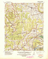
1952 Map of Jericho
USGS Topo · Published 1952About this map
The Mississippi River creates a labyrinthine boundary between Crittenden County, Arkansas, and Shelby County, Tennessee, in this mid-century survey. The landscape is defined by massive river features like Centennial Island and Brandywine Island, alongside former channels now identified as meander chutes. Human settlement is concentrated along the St Louis San Francisco RR and a complex network of drainage canals like Ditch No 1 and Ditch No 13, which suggest a concerted effort to reclaim the low-lying bottomlands for agriculture. This era shows a dense concentration of rural community anchors, from Frenchmans Bayou in the north to Jericho in the south, characterized by numerous small churches and schools such as St Pauls Ch & Cem and Lincoln Sch. The presence of Wapanocca Lake and the Shelby Recreational Area highlights the preserved wetlands and forests remaining amidst the alluvial plains.
Find a feature on this map
102 named features on this map. Tap any name to fly to it.
Don’t see what you’re looking for? This feature index may not catch every label — zoom into the map to look around manually.
Map Details
Editions of this 1952 Jericho Map
This is the sole edition of this map. No revisions or reprints were ever made.
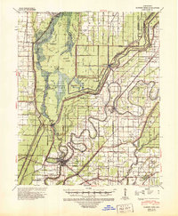
Other maps of this area

1916 · Memphis
USGS Topo · 1:62,500

1925 · Memphis
USGS Topo · 1:48,000

1927 · Memphis
USGS Topo · 1:62,500

1931 · Jericho
USGS Topo · 1:62,500

1939 · Jericho
USGS Topo · 1:62,500
1939 · Edmondson
USGS Topo · 1:62,500
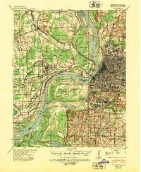
1939 · Memphis
USGS Topo · 1:62,500

1939 · Evadale
USGS Topo · 1:62,500

1940 · Deckerville
USGS Topo · 1:62,500
1941 · Marked Tree
USGS Topo · 1:62,500