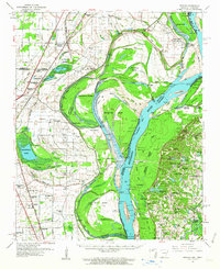
1961 Map of Jericho
USGS Topo · Published 1963About this map
The Mississippi River creates a complex landscape of shifting borders and seasonal waterways in this early 1960s survey of the Arkansas-Tennessee line. The area is defined by massive river bends and islands, including Centennial Island and Brandywine Island, which are separated from the mainland by chutes like Brandywine Chute. This delta environment supported numerous small agrarian communities and a dense network of country churches, such as Union Grove Ch and New Mt. Zion Ch. The inland terrain is characterized by oxbow lakes and bayous, notably Wapanocca Lake and Frenchmans Bayou.
Find a feature on this map
89 named features on this map. Tap any name to fly to it.
Don’t see what you’re looking for? This feature index may not catch every label — zoom into the map to look around manually.
Map Details
Editions of this 1961 Jericho Map
This is the sole edition of this map. No revisions or reprints were ever made.
Other maps of this area

1916 · Memphis
USGS Topo · 1:62,500

1925 · Memphis
USGS Topo · 1:48,000

1927 · Memphis
USGS Topo · 1:62,500

1931 · Jericho
USGS Topo · 1:62,500

1939 · Jericho
USGS Topo · 1:62,500

1939 · Edmondson
USGS Topo · 1:62,500

1939 · Memphis
USGS Topo · 1:62,500

1939 · Evadale
USGS Topo · 1:62,500

1940 · Deckerville
USGS Topo · 1:62,500

1941 · Marked Tree
USGS Topo · 1:62,500