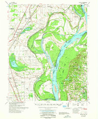
1962 Map of Jericho
USGS Topo · Published 1962About this map
Centennial Bend and the massive curves of the Mississippi River define this 1962 riverfront survey, where complex hydrology meets Arkansas and Tennessee agriculture. The landscape is a network of drainage ditches like Wananocca Ditch and old oxbow formations including Meneshea Lake and Swan Lake. Near the railroad tracks of the St. Louis San Francisco RR, small communities like Jericho and Clarkedale serve as local hubs, while numerous country churches and schools—such as Union Grove Ch and the Lincoln Sch—point to a densely settled rural population. Across the state line, the Shelby Forest (Recreational Area) occupies the bluffs above the river flats. The presence of numerous family cemeteries like Bledsoe Cem and Jacob's Cem along the levees provides significant genealogical landmarks for researchers of Crittenden and Shelby counties.
Find a feature on this map
122 named features on this map. Tap any name to fly to it.
Don’t see what you’re looking for? This feature index may not catch every label — zoom into the map to look around manually.
Map Details
Editions of this 1962 Jericho Map
This is the sole edition of this map. No revisions or reprints were ever made.
Other maps of this area

1916 · Memphis
USGS Topo · 1:62,500

1925 · Memphis
USGS Topo · 1:48,000

1927 · Memphis
USGS Topo · 1:62,500

1931 · Jericho
USGS Topo · 1:62,500

1939 · Jericho
USGS Topo · 1:62,500

1939 · Edmondson
USGS Topo · 1:62,500

1939 · Memphis
USGS Topo · 1:62,500

1939 · Evadale
USGS Topo · 1:62,500

1940 · Deckerville
USGS Topo · 1:62,500

1941 · Marked Tree
USGS Topo · 1:62,500