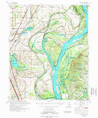
1975 Map of Jericho
USGS Topo · Published 1975About this map
Mississippi River meanders define the borderlands of Arkansas and Tennessee in this mid-1970s survey, revealing a landscape of dramatic river bends and active land reclamation. Large alluvial features like Brandywine Island, Centennial Island, and Dean Island dominate the waterway, while an extensive network of drainage projects such as Ditch No 15 and Ditch No 4 illustrate the effort to manage the flood-prone bottomlands. The St Louis San Francisco RR provides the primary transit spine through the Arkansas interior, connecting established settlements like Jericho and Frenchmans Bayou. The map also captures the ecological preservation efforts of the era, showing the Wapanocca National Wild Life Refuge and Meeman-Shelby State Park anchoring the wetlands. For genealogists and local historians, numerous country churches and cemeteries, including Jerusalem Ch, Paradise Ch, and St Paul Cem, remain as clear markers of the rural community structure of Crittenden and Shelby counties.
Find a feature on this map
116 named features on this map. Tap any name to fly to it.
Don’t see what you’re looking for? This feature index may not catch every label — zoom into the map to look around manually.
Map Details
Editions of this 1975 Jericho Map
This is the sole edition of this map. No revisions or reprints were ever made.
Other maps of this area

1916 · Memphis
USGS Topo · 1:62,500

1925 · Memphis
USGS Topo · 1:48,000

1927 · Memphis
USGS Topo · 1:62,500

1931 · Jericho
USGS Topo · 1:62,500

1939 · Jericho
USGS Topo · 1:62,500

1939 · Edmondson
USGS Topo · 1:62,500

1939 · Memphis
USGS Topo · 1:62,500

1939 · Evadale
USGS Topo · 1:62,500

1940 · Deckerville
USGS Topo · 1:62,500

1941 · Marked Tree
USGS Topo · 1:62,500