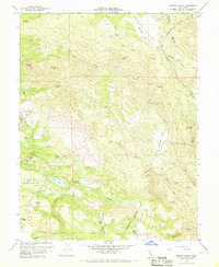
1958 Map of Jericho Valley
USGS Topo · Published 1968About this map
Putah Creek winds through the heart of this mid-century survey, defining a landscape marked by ranching, mining, and complex county boundaries. The intersection of Lake, Napa, and Yolo counties occurs in the high ground above Jericho Valley, where isolated operations like the Red Elephant Mine and various quarries suggest a history of resource extraction. Local family influence is evident through established locations such as Hennessey Ranch and Ink Ranch, while landmarks like Jim Dollar Mtn and Petticoat Mtn rise above the drainage basins.
Find a feature on this map
46 named features on this map. Tap any name to fly to it.
Don’t see what you’re looking for? This feature index may not catch every label — zoom into the map to look around manually.
Map Details
Editions of this 1958 Jericho Valley Map
4 editions found
Other maps of this area

1927 · Calistoga
USGS Topo · 1:62,500

1942 · St. Helena
USGS Topo · 1:62,500

1943 · Morgan Valley
USGS Topo · 1:62,500

1943 · Calistoga
USGS Topo · 1:62,500

1944 · Morgan Valley
USGS Topo · 1:62,500

1945 · Calistoga
USGS Topo · 1:62,500

1945 · St. Helena
USGS Topo · 1:62,500

1945 · Lower Lake
USGS Topo · 1:62,500

1947 · Santa Rosa
USGS Topo · 1:250,000

1949 · Santa Rosa
USGS Topo · 1:250,000