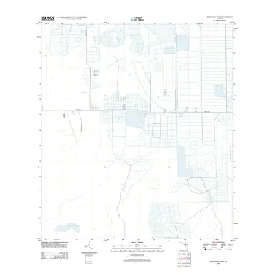
2012 Map of Jernigans Pond
USGS Topo · Published 2012About this map
Agricultural development and rural transport networks define this section of Saint Lucie County in the early 21st century. The landscape is marked by a distinctive grid of drainage canals and field patterns, illustrating the intensive land management common to this region of Florida. Water management is centered around Gomez Cr and the namesake Jernigans Pond, which sit amidst a systematic layout of access roads. Major thoroughfares such as Orange Ave and NE 224th St provide the primary east-west framework for the area, while local routes like Tripples Ranch Rd and Boyds Rd serve the interior parcels. This survey documents the transition between ranching lands and more structured agricultural irrigation systems, revealing the precise geometric carving of the terrain into productive blocks.
Find a feature on this map
7 named features on this map. Tap any name to fly to it.
Don’t see what you’re looking for? This feature index may not catch every label — zoom into the map to look around manually.
Map Details
Editions of this 2012 Jernigans Pond Map
This is the sole edition of this map. No revisions or reprints were ever made.
Other maps of this area

1953 · Okeechobee 1 SE
USGS Topo · 1:24,000

1953 · Fort Drum
USGS Topo · 1:24,000

1953 · Fellsmere 4 SE
USGS Topo · 1:24,000

1953 · Fellsmere 4 SW
USGS Topo · 1:24,000

1953 · Okeechobee 1 SW
USGS Topo · 1:24,000

1953 · Taylor Creek SE
USGS Topo · 1:24,000

1953 · Taylor Creek NE
USGS Topo · 1:24,000

1953 · Okeechobee 1 NE
USGS Topo · 1:24,000

1953 · Okeechobee 1 NW
USGS Topo · 1:24,000

1956 · Fort Pierce
USGS Topo · 1:250,000