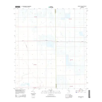
2015 Map of Jernigans Pond
USGS Topo · Published 2015About this map
The low-lying pastures and agricultural lands of Florida’s Treasure Coast are documented in this 2015 record of the boundary between St. Lucie and Okeechobee counties. The landscape is characterized by a precise grid of drainage canals and property lines, common to the region's ranching and citrus history. Jernigans Pond and the winding course of Cow Cr provide a natural contrast to the geometric layout of the surrounding citrus groves and fields. Major arterial access is provided by Orange Ave and NE 224th St, which bisect the surveyed area and connect the rural homesteads. The inclusion of Tripples Ranch Rd highlights the persistent ranching legacy that continues to define this section of the Florida interior.
Find a feature on this map
12 named features on this map. Tap any name to fly to it.
Don’t see what you’re looking for? This feature index may not catch every label — zoom into the map to look around manually.
Map Details
Editions of this 2015 Jernigans Pond Map
This is the sole edition of this map. No revisions or reprints were ever made.
Other maps of this area

1953 · Okeechobee 1 SE
USGS Topo · 1:24,000

1953 · Fort Drum
USGS Topo · 1:24,000

1953 · Fellsmere 4 SE
USGS Topo · 1:24,000

1953 · Fellsmere 4 SW
USGS Topo · 1:24,000

1953 · Okeechobee 1 SW
USGS Topo · 1:24,000

1953 · Taylor Creek SE
USGS Topo · 1:24,000

1953 · Taylor Creek NE
USGS Topo · 1:24,000

1953 · Okeechobee 1 NE
USGS Topo · 1:24,000

1953 · Okeechobee 1 NW
USGS Topo · 1:24,000

1956 · Fort Pierce
USGS Topo · 1:250,000