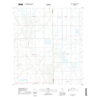
2018 Map of Jernigans Pond
USGS Topo · Published 2018About this map
Jernigans Pond and the surrounding marshlands sit at the boundary of St. Lucie and Okeechobee counties, representing a landscape defined by its intricate drainage patterns. The hydrology of this interior Florida terrain is shaped by meandering waterways like Gomez Creek, Cowbone Creek, and Cow Creek, which thread through the flat scrub and wetlands. These natural features are interspersed with a geometric grid of rural roads and section lines, indicating the area's transition into agricultural and ranching use.
Find a feature on this map
13 named features on this map. Tap any name to fly to it.
Don’t see what you’re looking for? This feature index may not catch every label — zoom into the map to look around manually.
Map Details
Editions of this 2018 Jernigans Pond Map
This is the sole edition of this map. No revisions or reprints were ever made.
Other maps of this area

1953 · Okeechobee 1 SE
USGS Topo · 1:24,000

1953 · Fort Drum
USGS Topo · 1:24,000

1953 · Fellsmere 4 SE
USGS Topo · 1:24,000

1953 · Fellsmere 4 SW
USGS Topo · 1:24,000

1953 · Okeechobee 1 SW
USGS Topo · 1:24,000

1953 · Taylor Creek SE
USGS Topo · 1:24,000

1953 · Taylor Creek NE
USGS Topo · 1:24,000

1953 · Okeechobee 1 NE
USGS Topo · 1:24,000

1953 · Okeechobee 1 NW
USGS Topo · 1:24,000

1956 · Fort Pierce
USGS Topo · 1:250,000