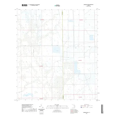
2021 Map of Jernigans Pond
USGS Topo · Published 2021About this map
Gomez Creek and Cowbone Creek wind through the wetlands of this Florida interior, marking a landscape defined by water and ranching. The boundary between Okeechobee and St. Lucie counties bisects the terrain, illustrating the jurisdictional divide in this rural expanse. Local transport is represented by the straight corridors of Co Rd 68 and the winding path of Tripples Ranch Rd, which navigate around extensive wetland systems. The southern portion of the map is anchored by Jernigans Pond and the reaches of Cow Creek. This survey details the complex hydrography of the region, where numerous unnamed marsh areas and small water bodies surround the primary drainage systems, reflecting the natural drainage patterns of the Florida peninsula before extensive modern development altered the local water table.
Find a feature on this map
13 named features on this map. Tap any name to fly to it.
Don’t see what you’re looking for? This feature index may not catch every label — zoom into the map to look around manually.
Map Details
Editions of this 2021 Jernigans Pond Map
This is the sole edition of this map. No revisions or reprints were ever made.
Other maps of this area

1953 · Okeechobee 1 SE
USGS Topo · 1:24,000

1953 · Fort Drum
USGS Topo · 1:24,000

1953 · Fellsmere 4 SE
USGS Topo · 1:24,000

1953 · Fellsmere 4 SW
USGS Topo · 1:24,000

1953 · Okeechobee 1 SW
USGS Topo · 1:24,000

1953 · Taylor Creek SE
USGS Topo · 1:24,000

1953 · Taylor Creek NE
USGS Topo · 1:24,000

1953 · Okeechobee 1 NE
USGS Topo · 1:24,000

1953 · Okeechobee 1 NW
USGS Topo · 1:24,000

1956 · Fort Pierce
USGS Topo · 1:250,000