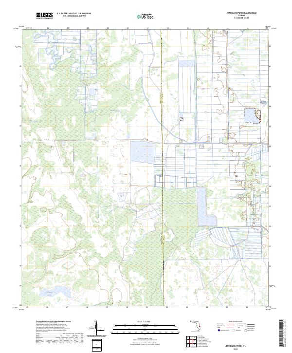
2024 Map of Jernigans Pond
USGS Topo · Published 2024About this map
The vast wetland and agricultural stretches of the Florida interior are defined by drainage and ranching infrastructure on the border of Okeechobee and St. Lucie Counties. In the southern reaches of this landscape, Jernigans Pond sits surrounded by seasonal wetlands and marshy terrain typical of the region. The map captures a transition between natural watercourses like Gomez Creek and Cowbone Creek and the organized grid of rural ranch lands. The presence of Tripples Ranch Rd and the primary artery of Co Rd 68 highlights the area's ongoing use for large-scale land management. This detailed survey provides a clear look at the intricate township and range divisions, such as t35s r37e, which govern the development and preservation of these central Florida plains.
Find a feature on this map
12 named features on this map. Tap any name to fly to it.
Don’t see what you’re looking for? This feature index may not catch every label — zoom into the map to look around manually.
Map Details
Editions of this 2024 Jernigans Pond Map
This is the sole edition of this map. No revisions or reprints were ever made.
Other maps of this area

1953 · Okeechobee 1 SE
USGS Topo · 1:24,000

1953 · Fort Drum
USGS Topo · 1:24,000

1953 · Fellsmere 4 SE
USGS Topo · 1:24,000

1953 · Fellsmere 4 SW
USGS Topo · 1:24,000

1953 · Okeechobee 1 SW
USGS Topo · 1:24,000

1953 · Taylor Creek SE
USGS Topo · 1:24,000

1953 · Taylor Creek NE
USGS Topo · 1:24,000

1953 · Okeechobee 1 NE
USGS Topo · 1:24,000

1953 · Okeechobee 1 NW
USGS Topo · 1:24,000

1956 · Fort Pierce
USGS Topo · 1:250,000