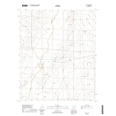
1981 Map of Jersey
USGS Topo · Published 1981About this map
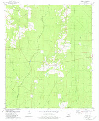
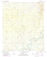
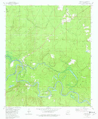
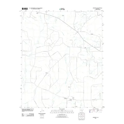
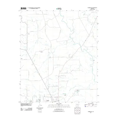
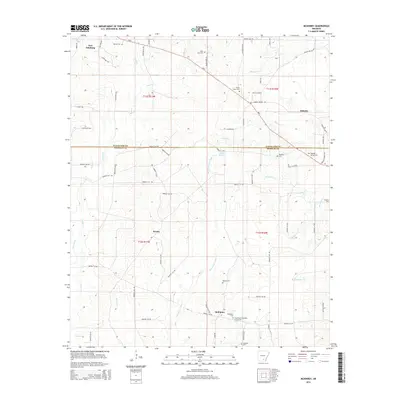
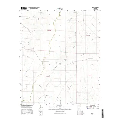
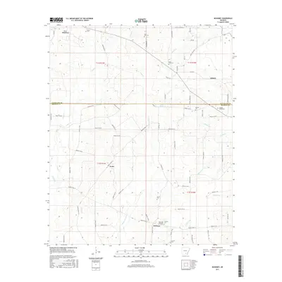
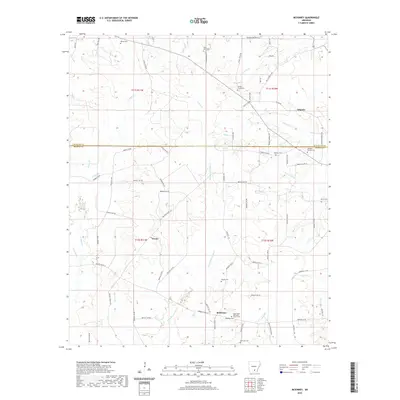
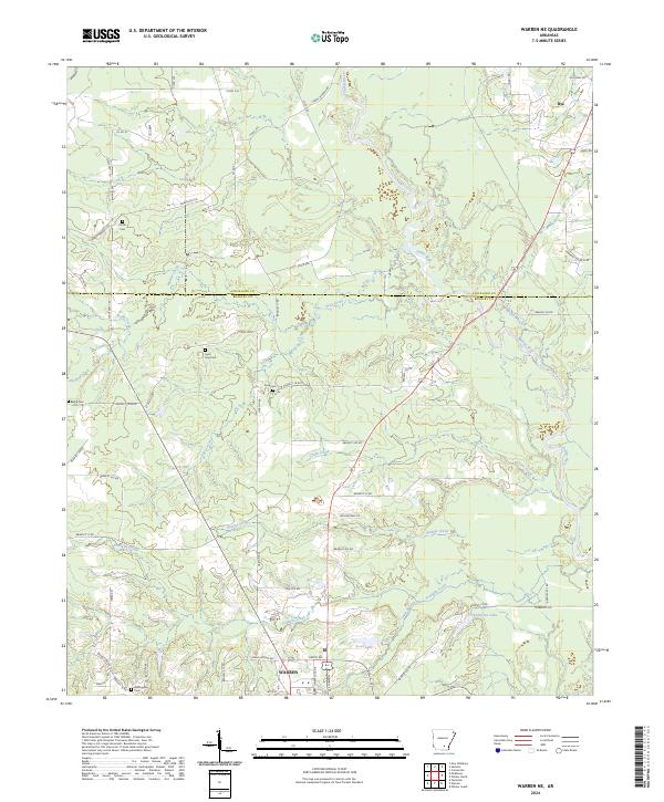
Jersey sits at the center of this 1980s landscape, serving as a focal point for a rural community defined by its waterways and small country churches. The terrain is deeply bisected by the south-flowing Moro Creek, which forms the boundary between Calhoun and Bradley Counties. This map documents a settlement pattern where social life centered around local congregations and family burying grounds, evidenced by the distribution of the Shady Grove Ch, Mt Zion Ch, and the Primitive Baptist Ch. Traditional land use is visible in the placement of the Mill Ford and various gravel pits, which dot the area alongside named drainages like Vellum Branch and Charivari Branch. Genealogists will find particular value in the clearly marked cemeteries, including Hienes Cem, Belin Cem, and Lavilliam Cem.
Find a feature on this map
30 named features on this map. Tap any name to fly to it.
Don’t see what you’re looking for? This feature index may not catch every label — zoom into the map to look around manually.
Map Details
Editions of this 1981 Jersey Map
This is the sole edition of this map. No revisions or reprints were ever made.
Historical Maps of Jersey Through Time
51 maps found

1934 Ingalls
Bradley County, AR
1937 Ingalls
Bradley County, AR

1939 Ingalls
Bradley County, AR
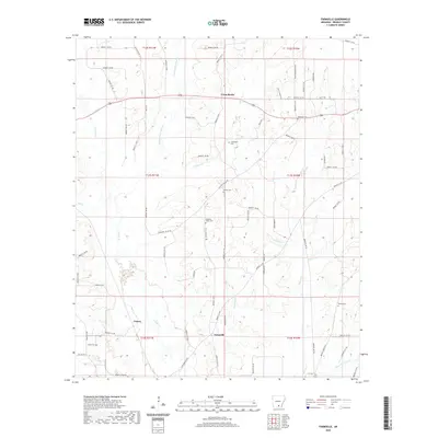
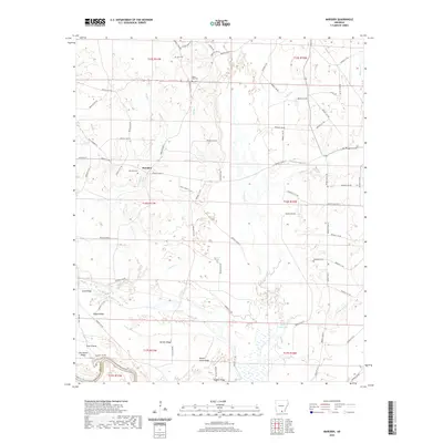
1971 Marsden
Bradley County, AR
1971 Sumpter
Bradley County, AR
1971 Vick
Bradley County, AR
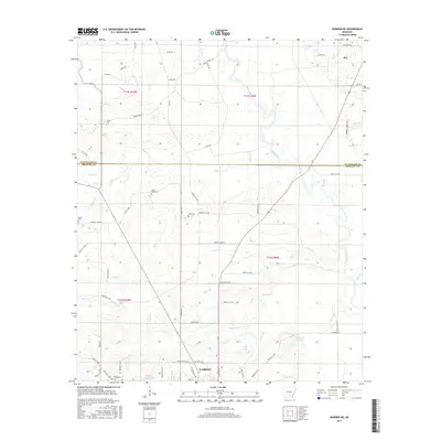
1973 Farmville
Bradley County, AR
1973 Mc Kinney
Bradley County, AR
1973 Warren NE
Bradley County, AR
1981 Jersey
Bradley County, AR
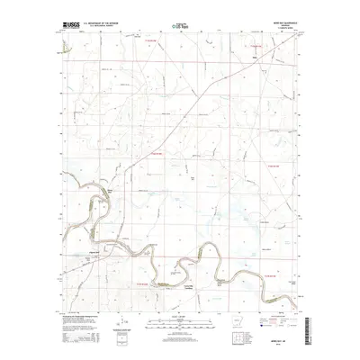
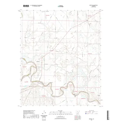
1981 Moro Bay
Bradley County, AR
2011 Farmville
Bradley County, AR
2011 Jersey
Bradley County, AR
2011 Marsden
Bradley County, AR
2011 McKinney
Bradley County, AR
2011 Moro Bay
Bradley County, AR
2011 Sumpter
Bradley County, AR
2011 Vick
Bradley County, AR
2011 Warren NE
Bradley County, AR
2014 Farmville
Bradley County, AR
2014 Jersey
Bradley County, AR
2014 Marsden
Bradley County, AR
2014 McKinney
Bradley County, AR
2014 Moro Bay
Bradley County, AR
2014 Sumpter
Bradley County, AR
2014 Vick
Bradley County, AR
2014 Warren NE
Bradley County, AR
2017 Farmville
Bradley County, AR
2017 Jersey
Bradley County, AR
2017 Marsden
Bradley County, AR
2017 McKinney
Bradley County, AR
2017 Moro Bay
Bradley County, AR
2017 Sumpter
Bradley County, AR
2017 Vick
Bradley County, AR
2017 Warren NE
Bradley County, AR
2020 Farmville
Bradley County, AR
2020 Jersey
Bradley County, AR
2020 Marsden
Bradley County, AR
2020 McKinney
Bradley County, AR
2020 Moro Bay
Bradley County, AR
2020 Sumpter
Bradley County, AR
2020 Vick
Bradley County, AR
2020 Warren NE
Bradley County, AR
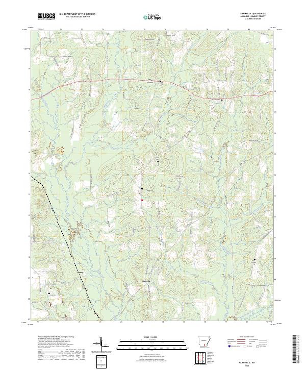
2024 Farmville
Bradley County, AR
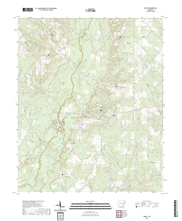
2024 Jersey
Bradley County, AR
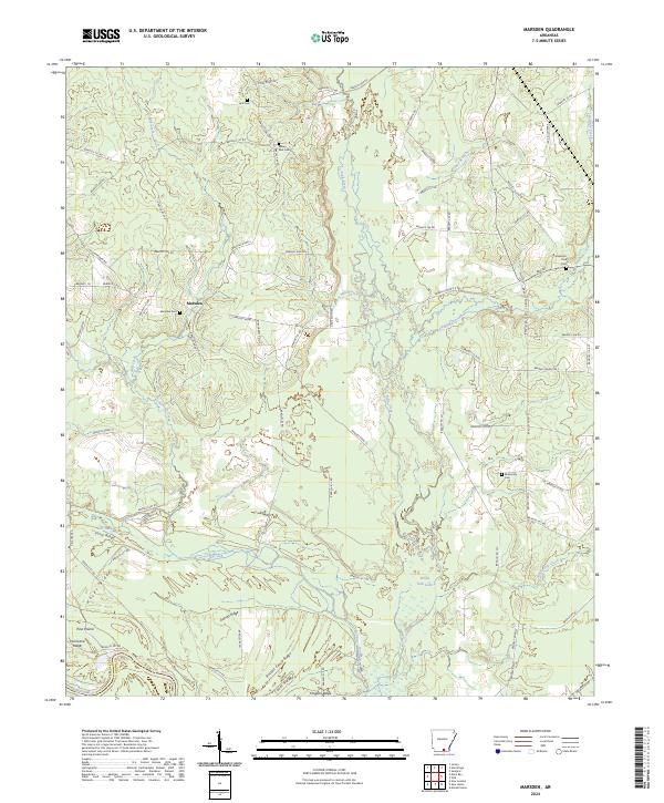
2024 Marsden
Bradley County, AR
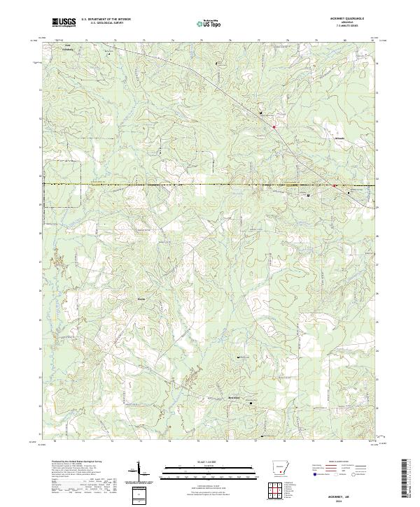
2024 McKinney
Bradley County, AR
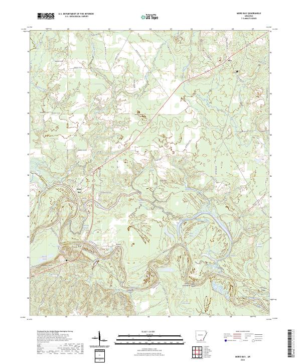
2024 Moro Bay
Bradley County, AR
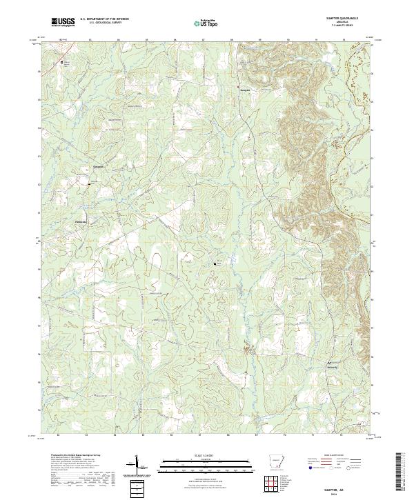
2024 Sumpter
Bradley County, AR
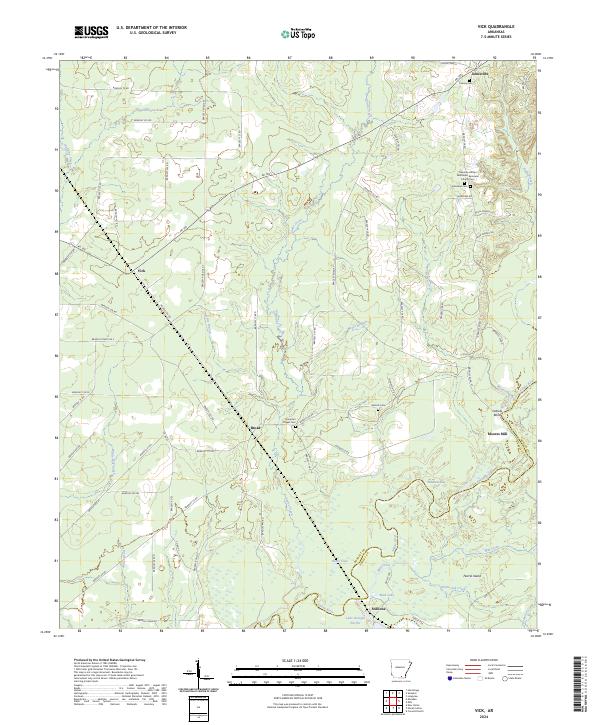
2024 Vick
Bradley County, AR
2024 Warren NE
Bradley County, AR