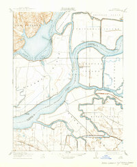
1910 Map of Jersey
USGS Topo · Published 1932About this map
The Sacramento River and San Joaquin River converge in this intricate delta landscape, defining a network of reclaimed islands and agricultural tracts. Surveyed between 1906 and 1908, the map illustrates the early 20th-century reliance on river transport, with numerous named steamboat stops and family-named wharves like Larsen Landing, Oulton Landing, and Bradford Landing providing vital links to the interior. Small settlements such as Emmaton and Jersey sit precariously along the levees, while several Pumping Plants underscore the engineering required to manage the low-lying terrain of Sherman Island and Twitchell Island. This era was marked by the transition from large-scale reclamation to established ranching and farming, as indicated by the orderly grid of the Bethel Tract and Webb Tract. The presence of Horseshoe Bend and several deep-water sloughs including Threemile Slough highlights the complex hydrology of this region before modern massive levee expansions.
Find a feature on this map
34 named features on this map. Tap any name to fly to it.
Don’t see what you’re looking for? This feature index may not catch every label — zoom into the map to look around manually.
Map Details
Editions of this 1910 Jersey Map
3 editions found
Other maps of this area

1896 · Mt. Diablo
USGS Topo · 1:62,500

1898 · Mt. Diablo
USGS Topo · 1:62,500

1907 · Antioch
USGS Topo · 1:62,500

1908 · Antioch
USGS Topo · 1:62,500

1910 · Rio Vista
USGS Topo · 1:31,680

1910 · Bouldin
USGS Topo · 1:31,680

1910 · Jersey
USGS Topo · 1:31,680

1910 · Isleton
USGS Topo · 1:31,680

1913 · Woodward Island
USGS Topo · 1:31,680

1914 · Brentwood
USGS Topo · 1:31,680