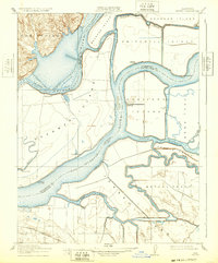
1910 Map of Jersey
USGS Topo · Published 1932About this map
Jersey sits at the heart of the Sacramento-San Joaquin River Delta, where the intricate network of waterways defined the life and commerce of the region during this 1910 survey. The convergence of the Sacramento River and San Joaquin River created a landscape of low-lying islands and tracts, including Brannan Island, Sherman Island, and Twitchell Island, many of which were managed via a series of pumping plants. This era was characterized by the river-landing economy, evidenced by the numerous small ports such as Larsen Landing, Oulton Landing, and Gutman Landing that served as vital transfer points for local agricultural goods. The map captures the early 20th-century reclamation efforts and the shifting sloughs like Threemile Slough and Dutch Slough that served as primary transit corridors before modern highway systems dominated the delta.
Find a feature on this map
33 named features on this map. Tap any name to fly to it.
Don’t see what you’re looking for? This feature index may not catch every label — zoom into the map to look around manually.
Map Details
Editions of this 1910 Jersey Map
3 editions found
Other maps of this area

1896 · Mt. Diablo
USGS Topo · 1:62,500

1898 · Mt. Diablo
USGS Topo · 1:62,500

1907 · Antioch
USGS Topo · 1:62,500

1908 · Antioch
USGS Topo · 1:62,500

1910 · Rio Vista
USGS Topo · 1:31,680

1910 · Bouldin
USGS Topo · 1:31,680

1910 · Jersey
USGS Topo · 1:31,680

1910 · Isleton
USGS Topo · 1:31,680

1913 · Woodward Island
USGS Topo · 1:31,680

1914 · Brentwood
USGS Topo · 1:31,680