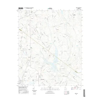
2017 Map of Jersey
USGS Topo · Published 2017About this map
Covington and the neighboring community of Oxford anchor the southwestern corner of this survey, where the expansion of modern infrastructure meets the established rural landscape of Walton and Newton Counties. The area is defined by a significant network of water resources, including the Cornish Cr Reservoir, Upper Williams Lake, and Wallace Lake, which shape the local geography alongside the Alcovy River. For those tracing family histories, the map identifies numerous small burial grounds and family plots such as the Carter Family Cem, Brodnax Cem, and Chapman Family Cem. The presence of several landing strips, including Poole Farm Airport and Alcovy Airport, alongside the larger Covington Municipal Airport, highlights the region's reliance on both aviation and traditional road networks like Old Hwy 81 and Old Hwy 138.
Find a feature on this map
169 named features on this map. Tap any name to fly to it.
Don’t see what you’re looking for? This feature index may not catch every label — zoom into the map to look around manually.
Map Details
Editions of this 2017 Jersey Map
This is the sole edition of this map. No revisions or reprints were ever made.
Other maps of this area

1896 · Monroe
USGS Topo · 1:125,000

1953 · Athens
USGS Topo · 1:250,000

1958 · Athens
USGS Topo · 1:250,000

1959 · Athens
USGS Topo · 1:250,000

1963 · Athens
USGS Topo · 1:250,000
1964 · Loganville
USGS Topo · 1:24,000

1964 · Between
USGS Topo · 1:24,000

1964 · Monroe
USGS Topo · 1:24,000

1964 · Porterdale
USGS Topo · 1:24,000

1964 · Covington
USGS Topo · 1:24,000