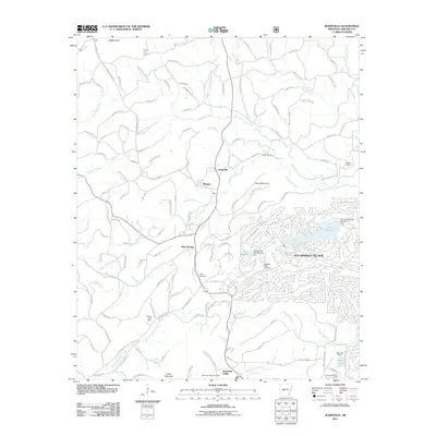
2011 Map of Jessieville
USGS Topo · Published 2011About this map
The Middle Fork Saline River and its tributaries carve a complex path through Garland County in this early 21st-century record. The planned community of Hot Springs Village occupies the eastern portion of the landscape, characterized by the waters of Lake Desoto and Lake Segovia, as well as the De Soto Golf Course. To the west, the settlements of Jessieville, Blakely, and Blue Springs maintain a more dispersed character, connected by a network of timber and access roads such as W Main Haul Rd and Buffalo Gap Rd.
Find a feature on this map
136 named features on this map. Tap any name to fly to it.
Don’t see what you’re looking for? This feature index may not catch every label — zoom into the map to look around manually.
Map Details
Editions of this 2011 Jessieville Map
This is the sole edition of this map. No revisions or reprints were ever made.
Other maps of this area

1890 · Benton
USGS Topo · 1:125,000

1890 · Hot Springs
USGS Topo · 1:125,000

1894 · Hot Springs
USGS Topo · 1:125,000

1894 · Benton
USGS Topo · 1:125,000

1955 · Little Rock
USGS Topo · 1:250,000

1956 · Little Rock
USGS Topo · 1:250,000

1960 · Little Rock
USGS Topo · 1:250,000

1963 · Paron SW
USGS Topo · 1:24,000

1964 · Little Rock
USGS Topo · 1:250,000
1966 · Hot Springs North
USGS Topo · 1:24,000