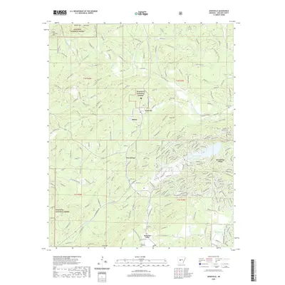
2020 Map of Jessieville
USGS Topo · Published 2020About this map
Jessieville sits at a crossroads of forest management and residential development within the sprawling Ouachita National Forest. The landscape is defined by the sharp relief of ridges like Short Mtn and the intricate drainage of the Middle Fork Saline River. To the south, the transition from wooded wilderness to planned community is evident in the dense street network of Hot Springs Village, which surrounds local water bodies including Lake Desoto and Lake Segovia. For those tracing local heritage, the map identifies several significant locations such as Blakely, Blue Springs, and Mountain Valley. Historical transit and land use patterns are visible through the maze of timber-hauling routes like W Main Haul Rd and E Main Haul Trl, which connect the interior forest to established sites like Mountain Valley Cem and Cosby Cem.
Find a feature on this map
240 named features on this map. Tap any name to fly to it.
Don’t see what you’re looking for? This feature index may not catch every label — zoom into the map to look around manually.
Map Details
Editions of this 2020 Jessieville Map
This is the sole edition of this map. No revisions or reprints were ever made.
Other maps of this area

1890 · Benton
USGS Topo · 1:125,000

1890 · Hot Springs
USGS Topo · 1:125,000

1894 · Hot Springs
USGS Topo · 1:125,000

1894 · Benton
USGS Topo · 1:125,000

1955 · Little Rock
USGS Topo · 1:250,000

1956 · Little Rock
USGS Topo · 1:250,000

1960 · Little Rock
USGS Topo · 1:250,000

1963 · Paron SW
USGS Topo · 1:24,000

1964 · Little Rock
USGS Topo · 1:250,000
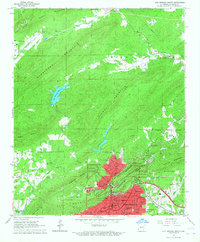
1966 · Hot Springs North
USGS Topo · 1:24,000