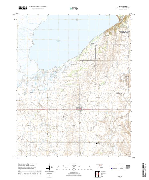
2022 Map of Jet
USGS Topo · Published 2022About this map
The town of Jet serves as the focal point of this Alfalfa County landscape, situated just south of the expansive Great Salt Plains Reservoir. The local grid is defined by streets such as Main St and Walnut St, reflecting a compact rural hub surrounded by an extensive network of range and township roads. These section lines, including N2710 Rd and E0230 Rd, crisscross the agricultural plains where numerous small watercourses like Spring Creek and Twin Spring Creek drain toward the salt plains.
Find a feature on this map
38 named features on this map. Tap any name to fly to it.
Don’t see what you’re looking for? This feature index may not catch every label — zoom into the map to look around manually.
Map Details
Editions of this 2022 Jet Map
This is the sole edition of this map. No revisions or reprints were ever made.
Other maps of this area

1955 · Woodward
USGS Topo · 1:250,000

1958 · Woodward
USGS Topo · 1:250,000

1969 · Jet
USGS Topo · 1:24,000

1969 · Goltry
USGS Topo · 1:24,000

1969 · Nash
USGS Topo · 1:24,000

1969 · Helena
USGS Topo · 1:24,000
1969 · Sand Creek
USGS Topo · 1:24,000

1969 · Manchester SW
USGS Topo · 1:24,000

1969 · Cherokee North
USGS Topo · 1:24,000

1969 · Jet SE
USGS Topo · 1:24,000