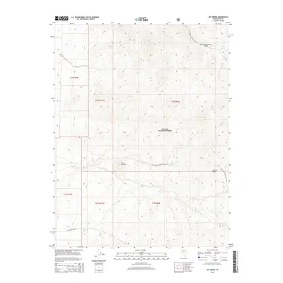
2014 Map of Jet Spring
USGS Topo · Published 2014About this map
Jet Spring and the surrounding high-altitude terrain of the Toquima Range dominate this 2014 survey of central Nevada. Located within the Toiyabe National Forest, the landscape is defined by its dramatic elevation changes, peaking at distinctive landmarks like Mt Ziggurat. The map documents a network of US Forest Service infrastructure, specifically the numerous development roads and trails that provide access to this isolated interior. From the northern reaches of West Northumberland Canyon to the southern sweep of New Moores Creek Rd, the cartography illustrates the intersection of public land management and the natural hydrology of the Great Basin. This edition provides researchers and hikers with a detailed view of the trail networks, including the Natl Forest Develop Road 397 Trl, as they existed in the early 21st century.
Find a feature on this map
15 named features on this map. Tap any name to fly to it.
Don’t see what you’re looking for? This feature index may not catch every label — zoom into the map to look around manually.
Map Details
Editions of this 2014 Jet Spring Map
This is the sole edition of this map. No revisions or reprints were ever made.
Other maps of this area

1907 · Tonopah
USGS Topo · 1:250,000

1908 · Tonopah
USGS Topo · 1:250,000

1926 · Roberts Mountains
USGS Topo · 1:250,000

1929 · Roberts Mountains
USGS Topo · 1:250,000

1955 · Millett
USGS Topo · 1:250,000

1956 · Millett Ranch
USGS Topo · 1:62,500

1956 · Tonopah
USGS Topo · 1:250,000

1959 · Tonopah
USGS Topo · 1:250,000

1959 · Millett
USGS Topo · 1:250,000

1960 · Wildcat Peak
USGS Topo · 1:62,500