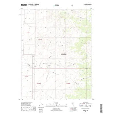
2018 Map of Jet Spring
USGS Topo · Published 2018About this map
Mt Ziggurat towers over a rugged section of the Toquima Range in Nye County, where deep canyons define the high-desert landscape. This 2018 survey by the U.S. Geological Survey documents a network of primitive roads and freight paths that crisscross the Toiyabe National Forest, including the Winter Freight Connector and Lower Mine Rd. These routes suggest a history of resource extraction and transit through difficult terrain, connecting remote sites like Moores Northumberland and the waters of Jet Spring. The land is heavily dissected by drainages such as West Northumberland Canyon and Three Mile Canyon, illustrating the complex topography encountered by early surveyors and miners in this part of central Nevada. The map preserves the specific locations of geographic landmarks like Zigguart and the seasonal flow of Moores Creek, essential for navigating the arid peaks.
Find a feature on this map
21 named features on this map. Tap any name to fly to it.
Don’t see what you’re looking for? This feature index may not catch every label — zoom into the map to look around manually.
Map Details
Editions of this 2018 Jet Spring Map
This is the sole edition of this map. No revisions or reprints were ever made.
Other maps of this area

1907 · Tonopah
USGS Topo · 1:250,000

1908 · Tonopah
USGS Topo · 1:250,000

1926 · Roberts Mountains
USGS Topo · 1:250,000

1929 · Roberts Mountains
USGS Topo · 1:250,000

1955 · Millett
USGS Topo · 1:250,000

1956 · Millett Ranch
USGS Topo · 1:62,500

1956 · Tonopah
USGS Topo · 1:250,000

1959 · Tonopah
USGS Topo · 1:250,000

1959 · Millett
USGS Topo · 1:250,000

1960 · Wildcat Peak
USGS Topo · 1:62,500