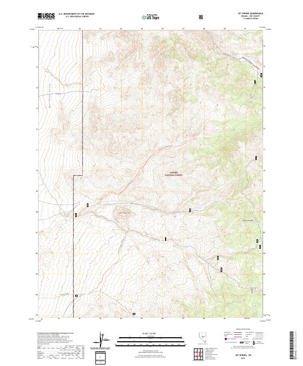
2021 Map of Jet Spring
USGS Topo · Published 2021About this map
Toiyabe National Forest dominates this high-altitude landscape in Nye County, where the eastern edge of the Big Smoky Valley meets the rising terrain of the Toquima Range. The map reveals a network of primitive routes and historical pathways, including the Ziggurat Trl and the Winter Freight Connector Trl, which navigate the steep gradients surrounding Mt Ziggurat. These trails suggest a history of resource extraction and high-desert transit, providing access to remote water sources like Jet Spring. In the southern portion of the sheet, Moores Creek cuts through the drainage basins of the southern Toquimas, illustrating the complex hydrology of Nevada's Great Basin. The systematic layout of township and range lines across this mountain-and-basin topography highlights the ongoing federal management of these public lands.
Find a feature on this map
14 named features on this map. Tap any name to fly to it.
Don’t see what you’re looking for? This feature index may not catch every label — zoom into the map to look around manually.
Map Details
Editions of this 2021 Jet Spring Map
This is the sole edition of this map. No revisions or reprints were ever made.
Other maps of this area

1907 · Tonopah
USGS Topo · 1:250,000

1908 · Tonopah
USGS Topo · 1:250,000

1926 · Roberts Mountains
USGS Topo · 1:250,000

1929 · Roberts Mountains
USGS Topo · 1:250,000

1955 · Millett
USGS Topo · 1:250,000

1956 · Millett Ranch
USGS Topo · 1:62,500

1956 · Tonopah
USGS Topo · 1:250,000

1959 · Tonopah
USGS Topo · 1:250,000

1959 · Millett
USGS Topo · 1:250,000

1960 · Wildcat Peak
USGS Topo · 1:62,500