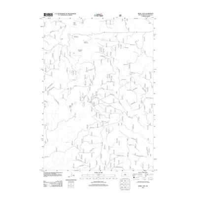
2012 Map of Jewel Cave
USGS Topo · Published 2012About this map
Jewel Cave Visitor Center and the Jewel Cave Campground anchor the northern landscape of this Custer County survey, where the rugged terrain is defined by deep cuts like West Hell Canyon and Tepee Canyon. The map reveals a transition from the protected federal lands of the cave system into a working ranching landscape. A network of named ranch holdings, including Wolf Ranch, Morrison Ranch, and the Y-4 Ranch, are scattered across the high draws and divides.
Find a feature on this map
68 named features on this map. Tap any name to fly to it.
Don’t see what you’re looking for? This feature index may not catch every label — zoom into the map to look around manually.
Map Details
Editions of this 2012 Jewel Cave Map
This is the sole edition of this map. No revisions or reprints were ever made.
Other maps of this area

1896 · Harney Peak
USGS Topo · 1:125,000

1901 · Harney Peak
USGS Topo · 1:125,000

1954 · Fourmile
USGS Topo · 1:24,000

1954 · Berne
USGS Topo · 1:24,000

1954 · Jewel Cave SE
USGS Topo · 1:24,000
1954 · Jewel Cave SW
USGS Topo · 1:24,000

1955 · Dead Horse Flats
USGS Topo · 1:24,000

1955 · Jewel Cave NW
USGS Topo · 1:24,000

1955 · Jewel Cave
USGS Topo · 1:24,000
1955 · Argyle
USGS Topo · 1:24,000