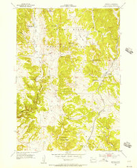
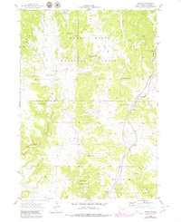
1955 Map of Argyle
USGS Topo · Published 1956About this map
Black Hills National Forest land defines the character of this mid-century topographic survey, where family holdings like the Dean Ranch and Nicolls Ranch are interspersed among the rugged draws and flats of Custer County. The mapping by the U.S. Geological Survey and the Atomic Energy Commission reveals a landscape in transition, where the Pleasant Valley Sch (Abandoned) stands as a reminder of earlier rural school districts, while the Argyle Sch remained active near the settlement of Argyle.
Find a feature on this map
20 named features on this map. Tap any name to fly to it.
Don’t see what you’re looking for? This feature index may not catch every label — zoom into the map to look around manually.
Map Details
Editions of this 1955 Argyle Map
5 editions found
Other maps of this area

1896 · Harney Peak
USGS Topo · 1:125,000

1901 · Harney Peak
USGS Topo · 1:125,000

1902 · Edgemont
USGS Topo · 1:125,000

1950 · Edgemont NE
USGS Topo · 1:24,000

1950 · Minnekahta
USGS Topo · 1:24,000

1951 · Minnekahta NE
USGS Topo · 1:24,000

1954 · Fourmile
USGS Topo · 1:24,000

1954 · Jewel Cave SE
USGS Topo · 1:24,000

1955 · Jewel Cave
USGS Topo · 1:24,000
1955 · Cicero Peak
USGS Topo · 1:24,000