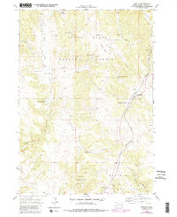
1955 Map of Argyle
USGS Topo · Published 1979About this map
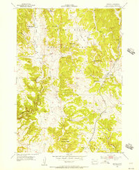
Black Hills National Forest provides the backdrop for this mid-century look at southwestern Custer County, where cattle ranching and rail transport defined the local economy. The settlement of Argyle serves as a focal point, supported by the Argyle Sch and situated along the tracks of the Chicago Burlington and Quincy railroad. The map documents a landscape of established family holdings, including the Dean Ranch, Nicolls Ranch, and Waisnan Ranch. Topographically, the area is carved by watercourses and canyons, most notably Pleasant Valley Creek and Red Canyon, while essential water sources like Dallon Spring and Upper Hand Spring suggest the critical nature of water rights in this arid environment. The inclusion of a Gravel Pit and Loring Siding further illustrates the intersection of industry and infrastructure in this part of the Black Hills.
Find a feature on this map
20 named features on this map. Tap any name to fly to it.
Don’t see what you’re looking for? This feature index may not catch every label — zoom into the map to look around manually.
Map Details
Editions of this 1955 Argyle Map
5 editions found
Other maps of this area

1896 · Harney Peak
USGS Topo · 1:125,000

1901 · Harney Peak
USGS Topo · 1:125,000

1902 · Edgemont
USGS Topo · 1:125,000

1950 · Edgemont NE
USGS Topo · 1:24,000

1950 · Minnekahta
USGS Topo · 1:24,000

1951 · Minnekahta NE
USGS Topo · 1:24,000

1954 · Fourmile
USGS Topo · 1:24,000

1954 · Jewel Cave SE
USGS Topo · 1:24,000

1955 · Jewel Cave
USGS Topo · 1:24,000
1955 · Argyle
USGS Topo · 1:24,000