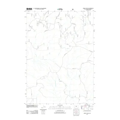
2012 Map of Jewel Cave SE
USGS Topo · Published 2012About this map
Richardson Spring and several other named water sources define the hydrologic character of this Custer County landscape. The area is defined by the drainages of Pass Creek and the E Fork Hawkwright Cr, where a network of forest roads and trails provides access to the backcountry. The map details a transition between the open expanses of Pleasant Valley and more structured terrain at Hawkwright. Named landmarks like Rogers Shack Spring and Pine Tree Spring offer specific points of reference for local historians or genealogists tracing land use in this part of South Dakota. The presence of numerous developed springs suggests a long history of water management for livestock or early forest habitation, connected by routes such as Wood Spring Rd and Pass Creek Rd.
Find a feature on this map
31 named features on this map. Tap any name to fly to it.
Don’t see what you’re looking for? This feature index may not catch every label — zoom into the map to look around manually.
Map Details
Editions of this 2012 Jewel Cave SE Map
This is the sole edition of this map. No revisions or reprints were ever made.
Other maps of this area

1896 · Harney Peak
USGS Topo · 1:125,000

1901 · Harney Peak
USGS Topo · 1:125,000

1902 · Edgemont
USGS Topo · 1:125,000

1950 · Burdock
USGS Topo · 1:24,000

1950 · Edgemont NE
USGS Topo · 1:24,000

1950 · Minnekahta
USGS Topo · 1:24,000

1954 · Fourmile
USGS Topo · 1:24,000

1954 · Jewel Cave SE
USGS Topo · 1:24,000
1954 · Jewel Cave SW
USGS Topo · 1:24,000

1955 · Jewel Cave NW
USGS Topo · 1:24,000