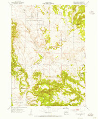
1954 Map of Jewel Cave SW
USGS Topo · Published 1976About this map
The Black Hills National Forest dominates this mid-century topographic study, a collaboration between the Geological Survey and the Atomic Energy Commission. The landscape is defined by the sharp rise of the Elk Mountains and a complex network of drainage ravines including Tepee Canyon, Schenk Canyon, and the appropriately named Hell Canyon. Human infrastructure is sparse, characterized by isolated water sources and small-scale livestock improvements such as Walsh Well, Putnam Dam, and Breasne Dam.
Find a feature on this map
14 named features on this map. Tap any name to fly to it.
Don’t see what you’re looking for? This feature index may not catch every label — zoom into the map to look around manually.
Map Details
Editions of this 1954 Jewel Cave SW Map
3 editions found
Other maps of this area

1896 · Harney Peak
USGS Topo · 1:125,000

1899 · Newcastle
USGS Topo · 1:125,000

1901 · Harney Peak
USGS Topo · 1:125,000

1901 · Newcastle
USGS Topo · 1:125,000

1902 · Edgemont
USGS Topo · 1:125,000

1950 · Burdock
USGS Topo · 1:24,000

1950 · Edgemont NE
USGS Topo · 1:24,000

1951 · Dewey
USGS Topo · 1:24,000

1951 · Twentyone Divide
USGS Topo · 1:24,000

1951 · Clifton
USGS Topo · 1:24,000